Learning Hub
Geography
Geography at Bessemer inspires the children to see themselves as geographers. The curriculum enables them to fully understand the interaction between human and physical geographical processes. Children access a range of thematic and regional studies, placing their identity and locality at the heart of learning, establishing connections on a local to global scale. Through practical and creative activities, children are taught to apply their skills and knowledge to understand why the world is the way it is today, and what it will be like in the future. Knowledge and skills are taught in a way that enables the children to enquire, carry out fieldwork and develop expert map skills. Geography is present across the curriculum, providing a rich web of knowledge and skills to help connect learning.
EYFS
In EYFS at Bessemer, children begin to explore geography through observation, discussion, storytelling, and hands-on experiences. They learn to draw simple maps of familiar places, such as their journey around school or features of the playground, and describe their immediate environment through drawings and conversation.
Through stories like We’re Going on a Lion Hunt and The Snail and the Whale, children compare their local environment to places around the world, using maps to locate countries like the UK and Tanzania. They explore the natural world and begin to notice similarities and differences between environments and ways of life.
Activities such as Culture and Diversity Celebration Week help children reflect on their own backgrounds and learn about others, developing an early sense of place, diversity, and global awareness.
Year 1
In Year 1, children begin to explore their place in the world, starting with their immediate surroundings and expanding to distant places across the globe.
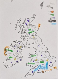
Through the Explorers – Our Local Area topic, children use simple fieldwork and observational skills to study their school and local environment. They learn to identify human and physical features, use basic geographical vocabulary, and create simple maps using symbols and keys. They also explore the four countries of the UK, their capital cities, and the concept of Europe as their home continent.
In Looking After Our World – Polar Regions, children journey to the Arctic and Antarctic. They learn to locate hot and cold regions on a map, understand climate and weather differences, and compare these extreme environments with their own locality. They are introduced to the idea of climate change and its impact on people, animals, and places around the world.
Finally, in Looking After Our World – The Amazon, children explore the Amazon Rainforest through sensory experiences, maps, and stories. They compare life in the Amazon with life in the UK, learn about deforestation, and begin to understand the importance of protecting our planet.
Year 2
In Year 2, children build on their geographical knowledge by exploring their own country, contrasting global locations, and the changes that occur over time in different environments.
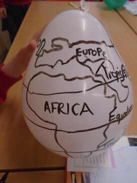
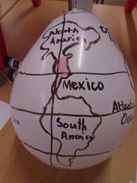
The year begins with the topic Continents and Oceans – Pirates, where children use maps, globes, and atlases to locate the UK, its surrounding seas, and begin to identify the world’s seven continents and five oceans. Using compass directions and map skills, they create treasure maps and describe routes, developing a strong understanding of key geographical terms and features.
In Hot Places – Kenya, children travel virtually to East Africa to study life in a contrasting country. Using a range of resources, including maps, aerial photographs, and digital tools, they locate Kenya and explore its human and physical geography. They compare a region in Kenya with one in the UK, considering similarities and differences in climate, landscape, and daily life.
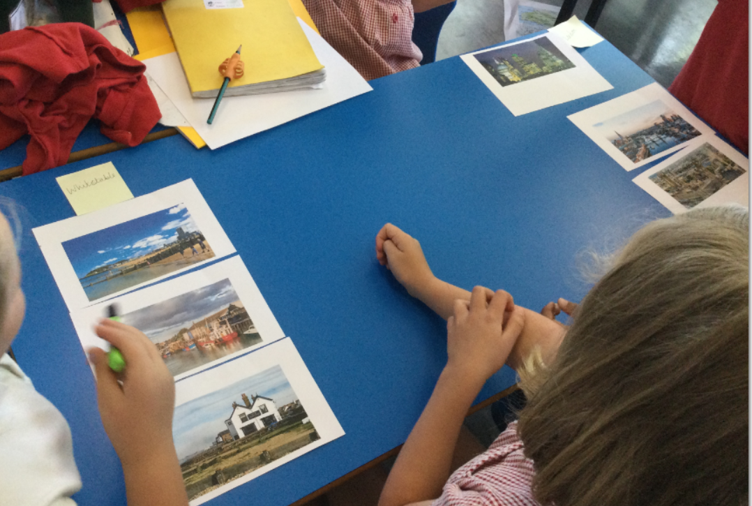
Finally, in The Seaside, children revisit their knowledge of the UK, exploring its coastal towns past and present. They investigate how human and physical features of seaside resorts have changed over time, using fieldwork, maps, and photographs. This unit helps children develop their understanding of environmental change and encourages them to reflect on how people and places are connected.
Throughout Year 2, children expand their locational and place knowledge, learn to interpret maps and photographs, and begin to make meaningful comparisons between places around the world.
Year 3
The year begins with Mountains and Volcanoes, where children use maps, atlases, and digital tools to explore some of the world's most impressive natural features. They learn how mountains and volcanoes are formed, identify their key characteristics, and compare mountainous regions around the world—including a detailed look at Mount Everest and a UK mountain.
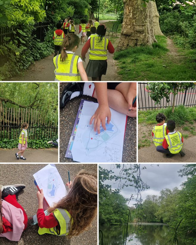
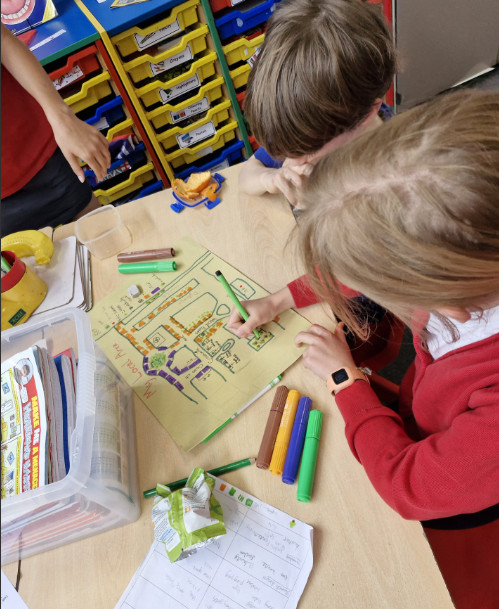
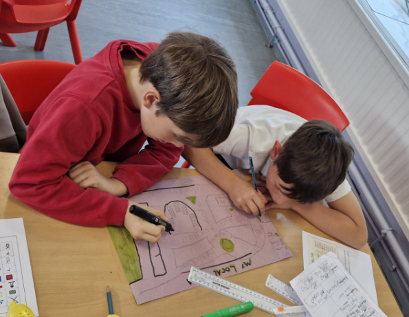
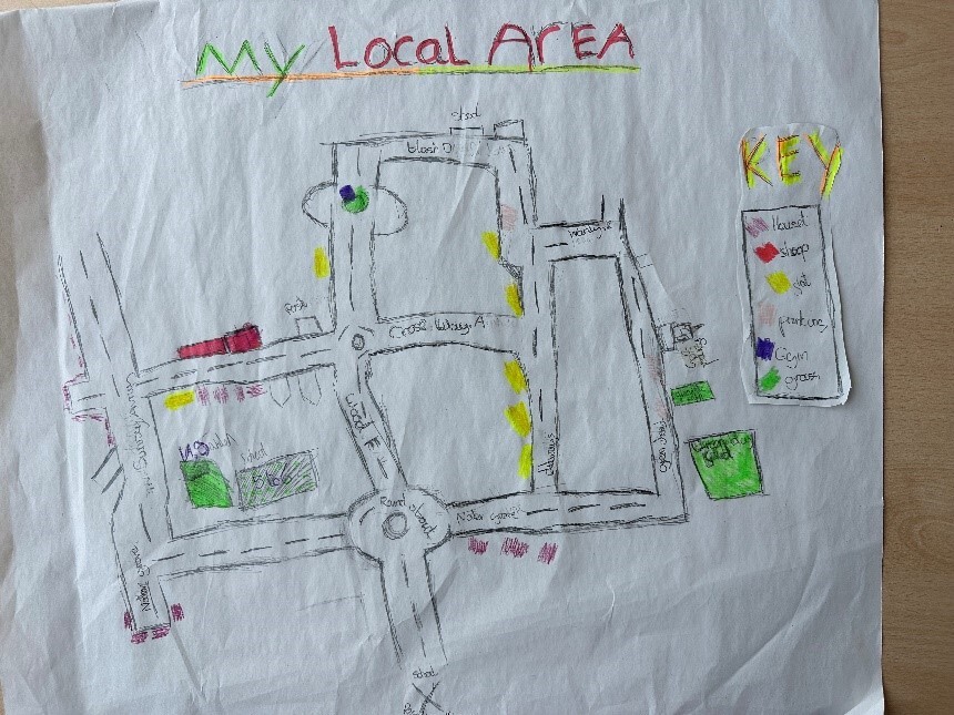
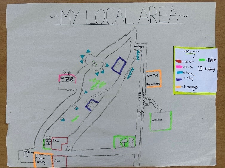
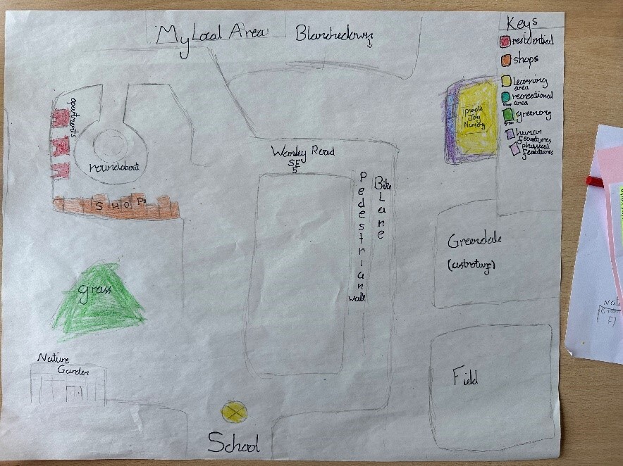
In Conservation and My Local Area, the focus is on the children’s own locality. Using fieldwork and mapping tools, including Ordnance Survey maps and digital resources, children explore how their area has changed over time. They investigate land use, transport, housing, and green spaces, going on walks around the local area and creating their own maps.
The final unit in year 3 is South America, which focuses on climate and biomes. Children identify the countries that make up South America, the surrounding seas and geographical features of the continent, including capital cities, deserts, mountain ranges, the Amazon rainforest and the Amazon river. Children learn about the different climate zones and biomes across the continent and why they differ. They then look at what life is like in Rio and compare Brazil and the UK. Finally, the children look at some of the climate change issues that South America is facing.
Year 4
In year 4, the children study rivers, food & agriculture and oceans.
The year begins with the Rivers topic, where children learn about the journey of a river, from source to mouth, using appropriate geographical vocabulary. They also learn about the Water Cycle, linking to the science curriculum, and how rivers are used by humans. In their end of unit write, children compare the River Thames, the Amazon River and the River Seine. As part of this unit, pupils conduct fieldwork at the River Thames, using a range of methods to observe, measure, and record data in a real-world context.
Here are some amazing models and diagrams the children made showing the course of a river.
In Food and Agriculture, children investigate where food comes from and how geography influences what we eat. A visit to the local supermarket allows them to trace the origin of different foods and map how far these items have travelled. They create maps and graphs to present their findings, learning about climate zones, food miles, and why we import food from other countries. The unit also explores the environmental impact of transporting food, the benefits and challenges of global trade, and how to make sustainable choices. Children learn about Fairtrade, British agriculture, and food sustainability. In recent years, Year 4 have also taken part in workshops at Vauxhall City Farm, where they discover how food grows and the journey from farm to table.
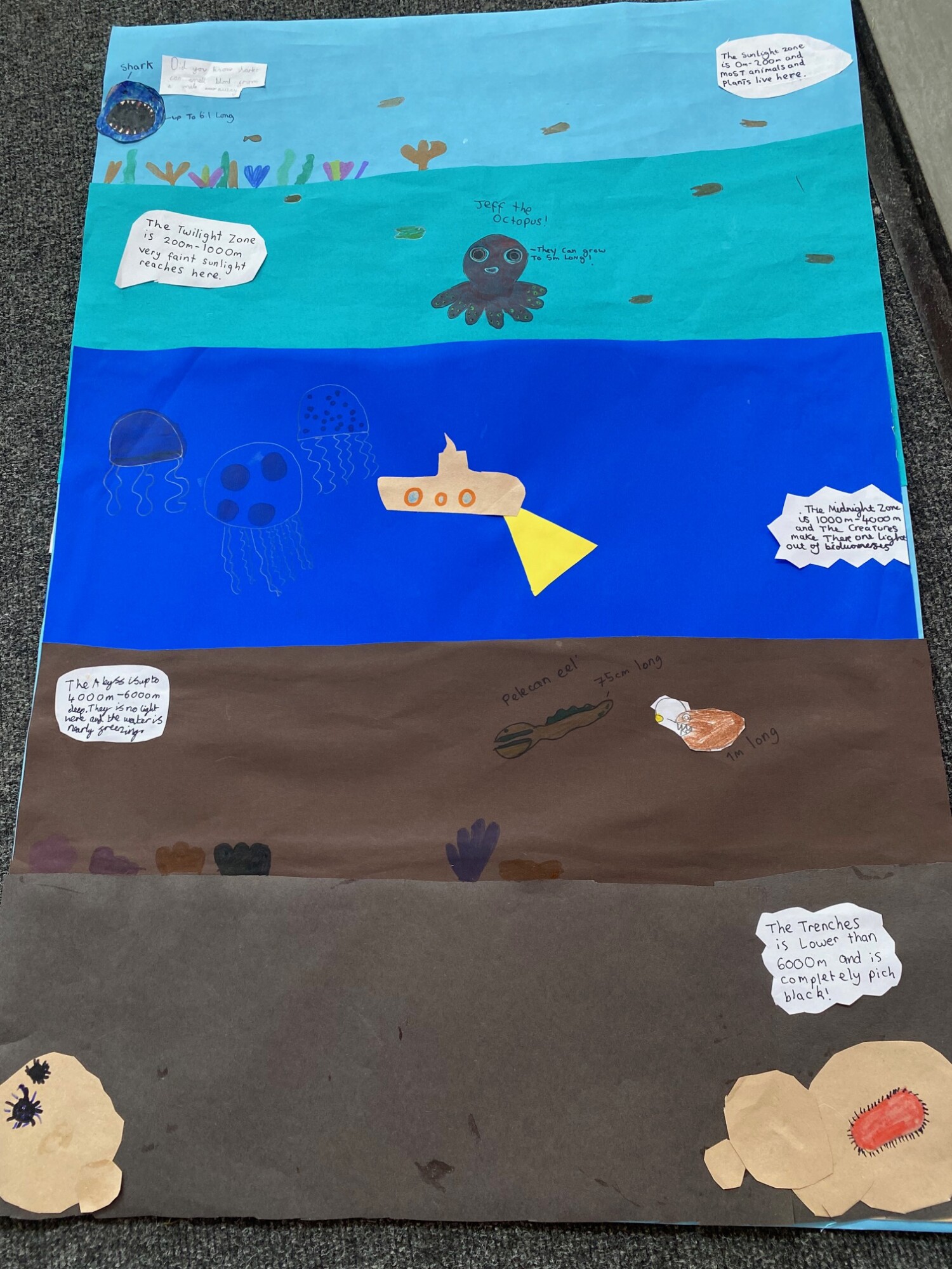
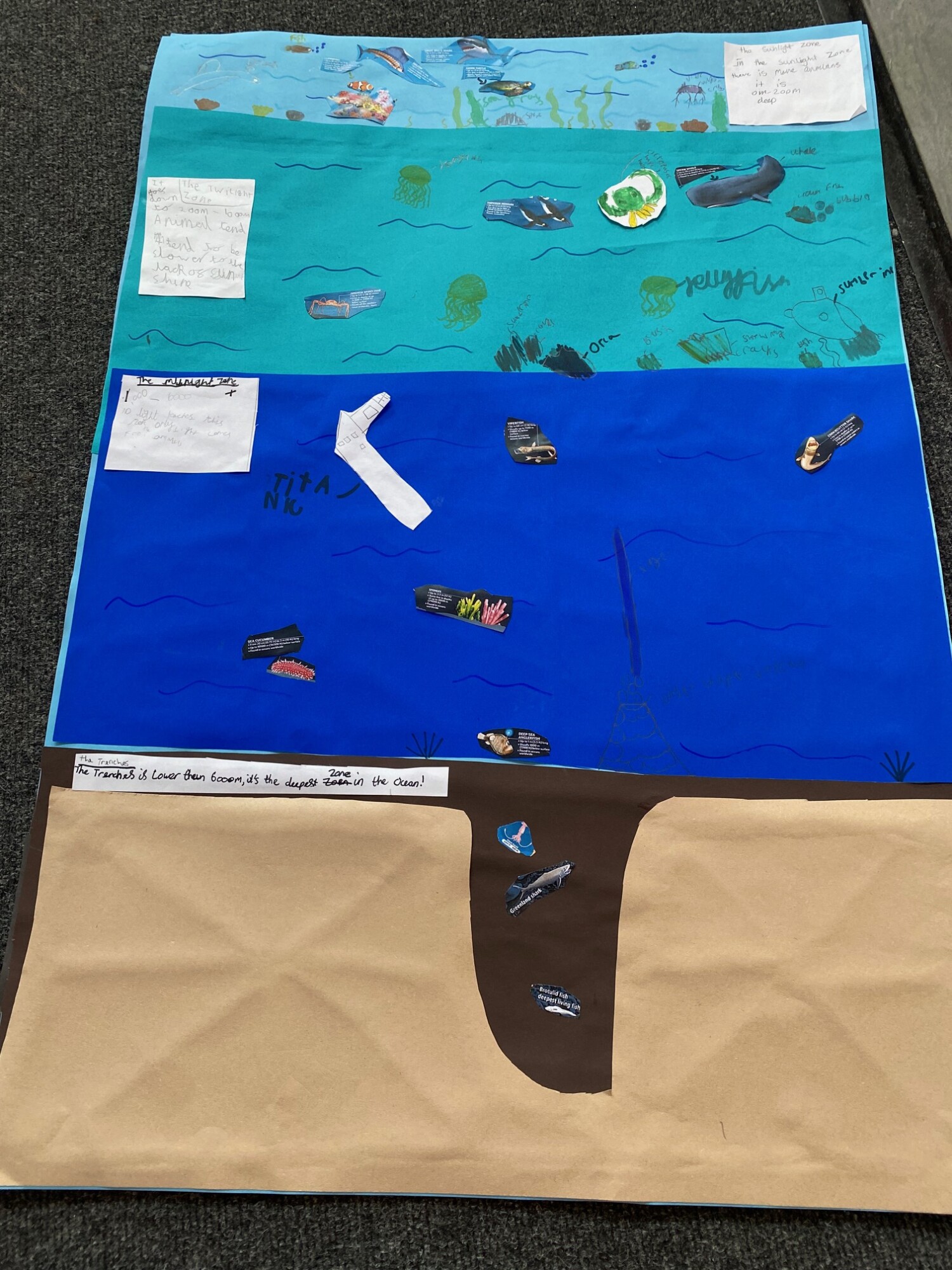
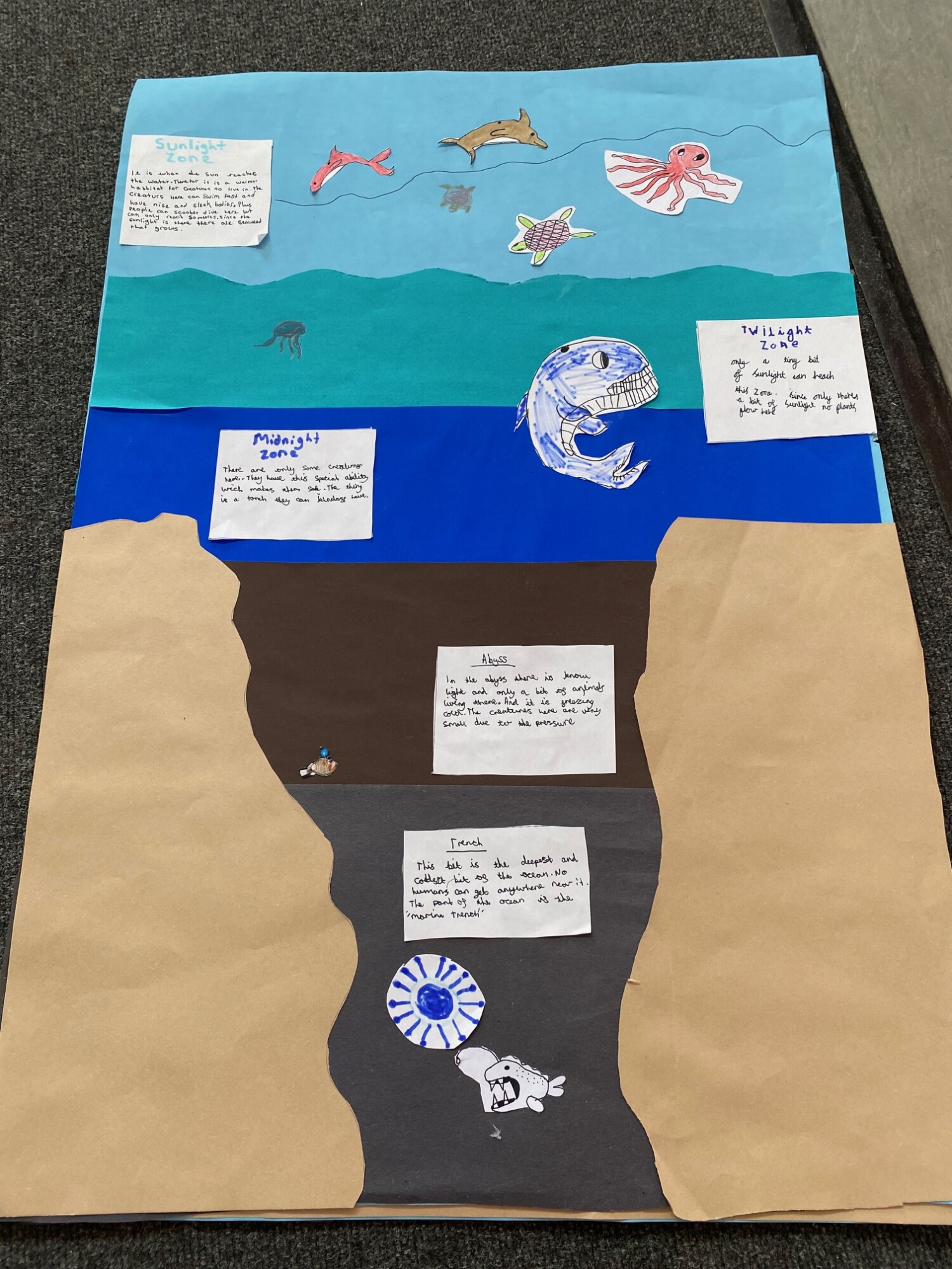
In the Oceans unit, children explore the layers of the ocean, its importance to life on Earth, and the different ways oceans are used—from food and transport to recreation. They learn about the threats facing ocean environments, such as climate change and pollution, and discuss ways we can protect marine ecosystems. A highlight of this unit is a visit to the Science Museum, where they take part in a workshop that deepens their understanding of ocean science and conservation.
Year 5
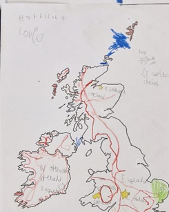
The year begins with The UK unit, where children explore what makes Britain unique. They study the human and physical geography of the UK, including major cities, rivers, mountains, and land use. Using maps, Ordnance Survey tools, and digital resources, they examine how geography has changed over time and compare different regions. This unit links to history and British values, highlighting the cultural and geographical diversity within the UK.
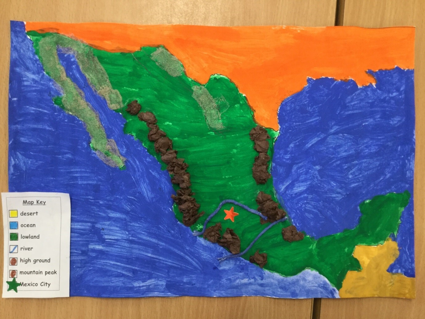
Next, in the North America unit, children explore the continent’s countries, environmental regions, climate zones, and key physical and human features, with a special focus on Mexico. They compare Mexico’s geography with another region in North America and with an area of the UK, considering economic activity, climate, and environmental impacts to develop a wider global perspective.
The final unit, The Environment, focuses on climate change, with a particular emphasis on deforestation in the Amazon rainforest. Children learn about the causes and effects of deforestation and how it relates to global climate change. They explore the impact on wildlife, indigenous communities, and the planet’s health, and discuss ways humans can help protect the environment. This unit encourages children to consolidate their geographical knowledge and understand the urgent need for sustainable actions.
Year 6
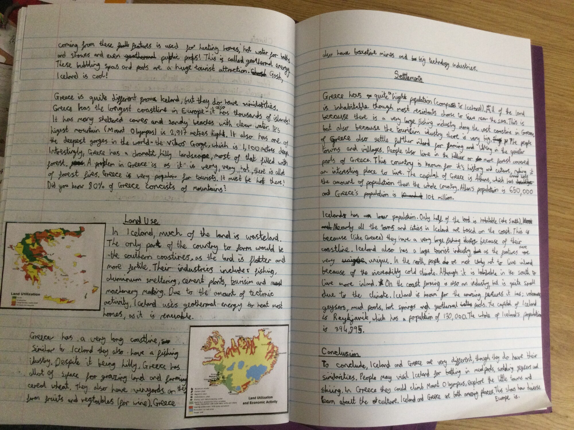
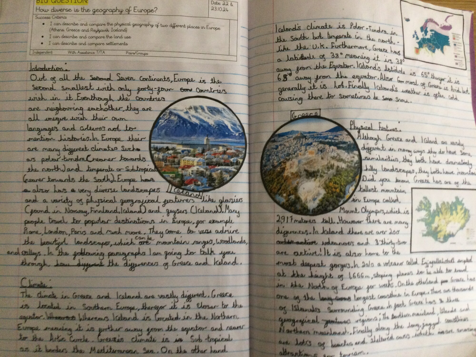
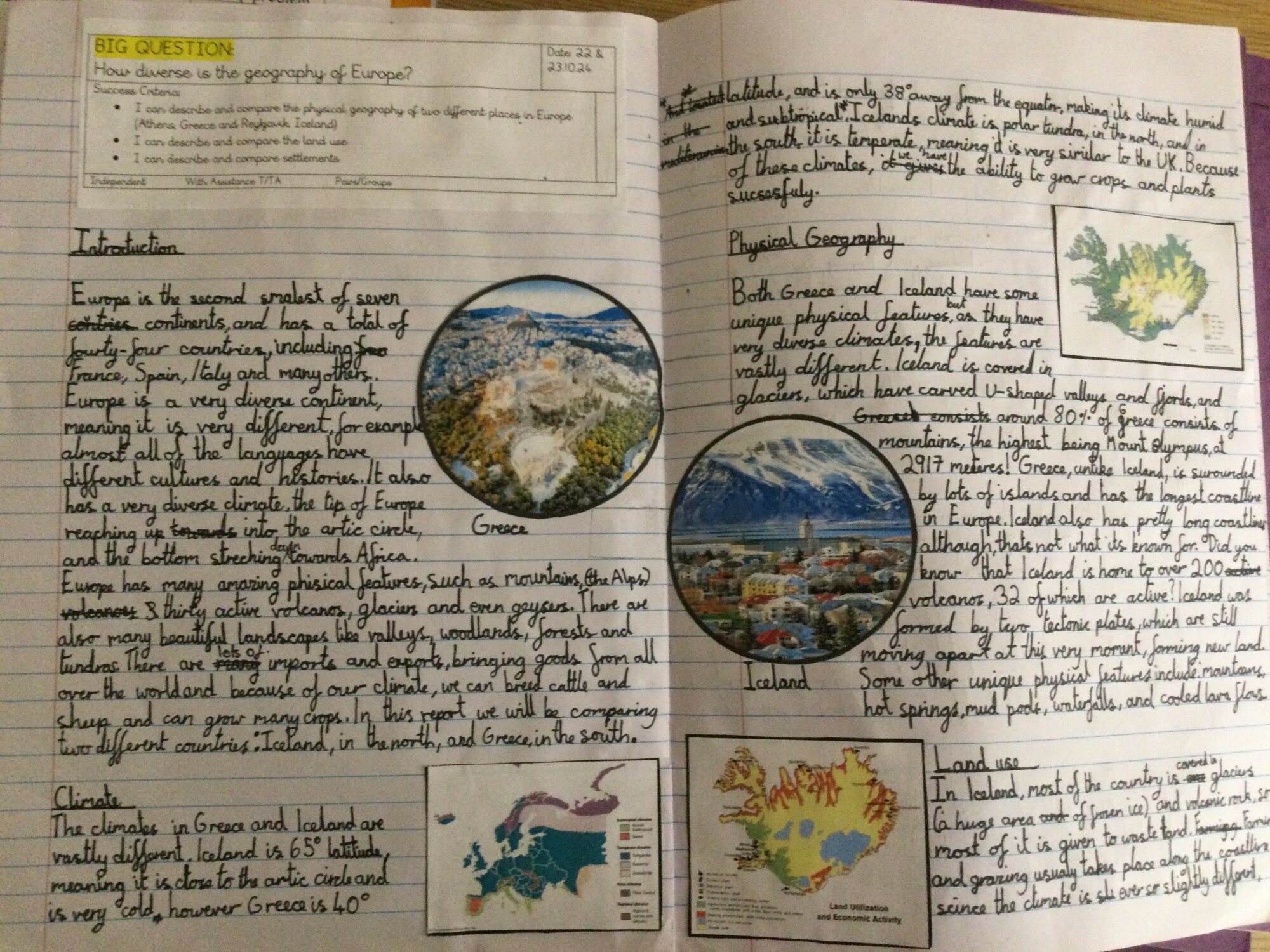
In year 6, children learn about Europe and Japan. In the Europe topic, children learn about many of the countries in Europe, choosing one to research in more depth. They explore the Mediterranean region, discussing why it is such a popular tourist destination. The topic also covers migration to Greece, where children investigate push and pull factors influencing why people travel there. Finally, they conduct a comparative study of two cities—Reykjavik (Iceland) and Athens (Greece)—examining differences and similarities in physical geography, land use, and settlements.
In the Japan topic, children focus on both physical and human geography. They revisit key concepts learned earlier, such as earthquakes and volcanoes, by studying Japan’s location on the Pacific Ring of Fire and the tectonic plate boundaries responsible for frequent natural disasters in the area. Children learn about Japan’s climate, landscape, and the risks posed by earthquakes and volcanic activity.
Practical activities enrich the learning experience: children create contour maps to understand elevation, explore earthquake-proof building designs, build model volcanoes, and prepare weather reports for a Japanese city.
How could you help with your child’s learning at home?
A five minute conversation a couple of times a week can open up a whole new world of thinking and enjoyment of geography. It isn’t all about maps! Maybe you could try out one of the suggestions below.
o Learn a new country and capital city every week (http://gegraphy.about.com/od/countryinformation/a/capitals.htm)
o Have a 5 minute chat abut geography in the news, e.g. the location and effect of an earthquake, volcano or hurricane, or a local planning issue.
o Identify different types of homes as you walk home from school, e.g. flats, terraced houses, semi-detached homes.
o Look for different types of land use while you walk home, e.g. transport (roads, trains, aeroplanes, canals and rivers), homes, businesses, parks and recreational areas, derelict land.
o Ask your child a “What if…?” question, linking it to the effect on people, places and the environment – e.g. What if we didn’t have any electricity? What if we no longer had mobile phones? What if water stopped flowing from our taps? What if all of the bees in the world died?
Geography resources
You could introduce your child to some of the geographical websites and online resources available that bring the world of Geography to their fingertips. Here are a few suggestions.
§ Geography games and homework help are available from Ordnance Survey.
http://mapzone.ordnancesurvey.co.uk/mapzone/
§ National Geographic Kids has a website packed full of fascinating facts, games and quizzes.
http://kids.nationalgeographic.com/
§ Maps at your fingertips!
http://www.worldatlas.com/
§ Guess where you are in the world using this amazing Geoguessr game!
http://geoguessr.com/ This game is Popular at Bessemer!