Learning Hub
Geography
History and geography are central to the curriculum at Keyworth Primary School and are the focus of our half-termly topics. We take a creative approach to the curriculum so that our children become fully immersed in each of these subjects, coming away with a secure knowledge base and skill set that is built upon each year.
Progression in Geography
Year 1
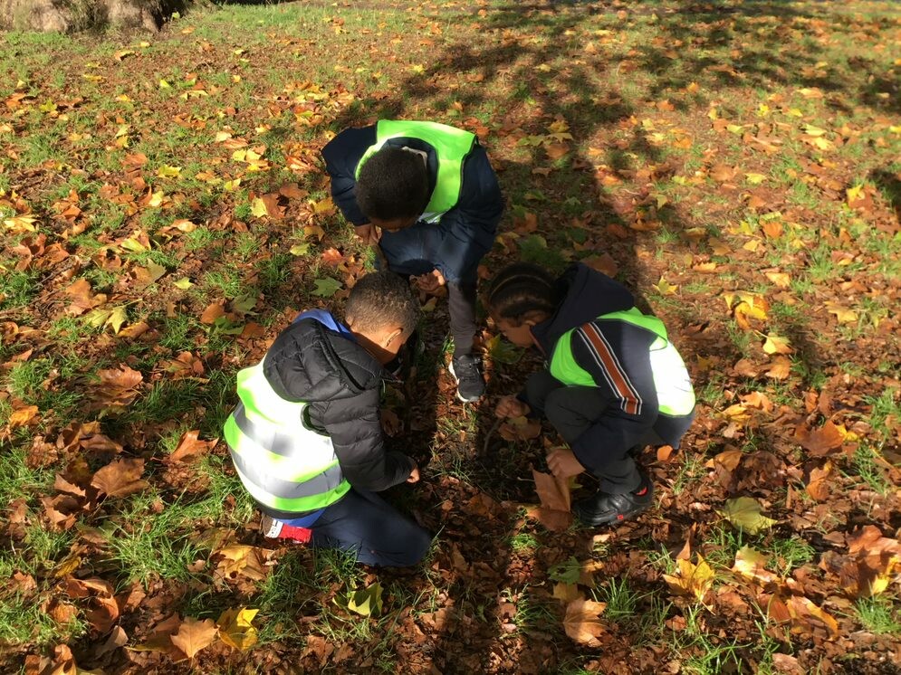
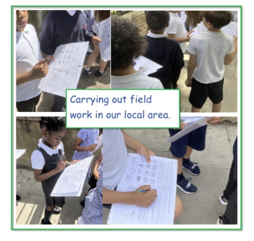
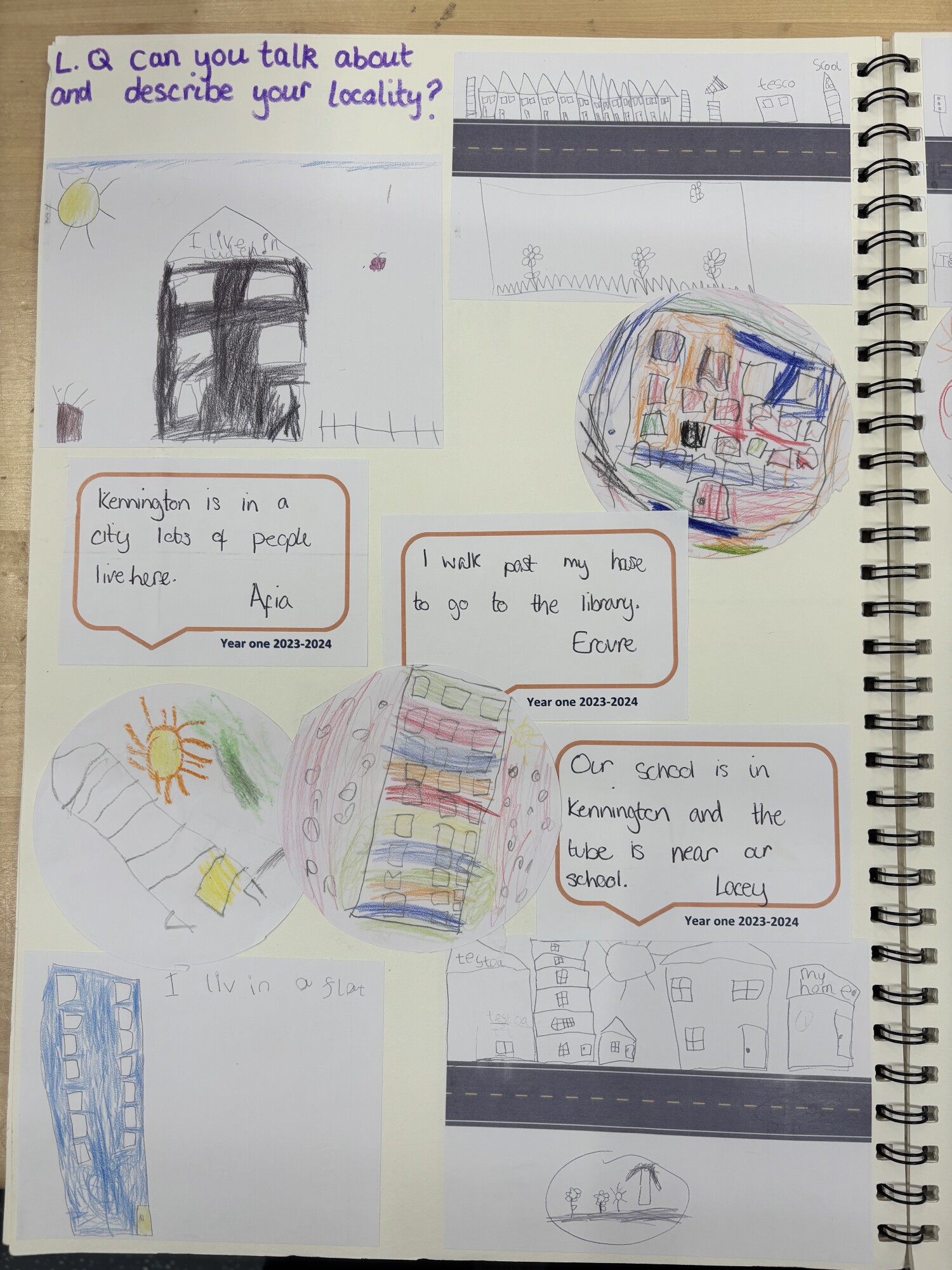
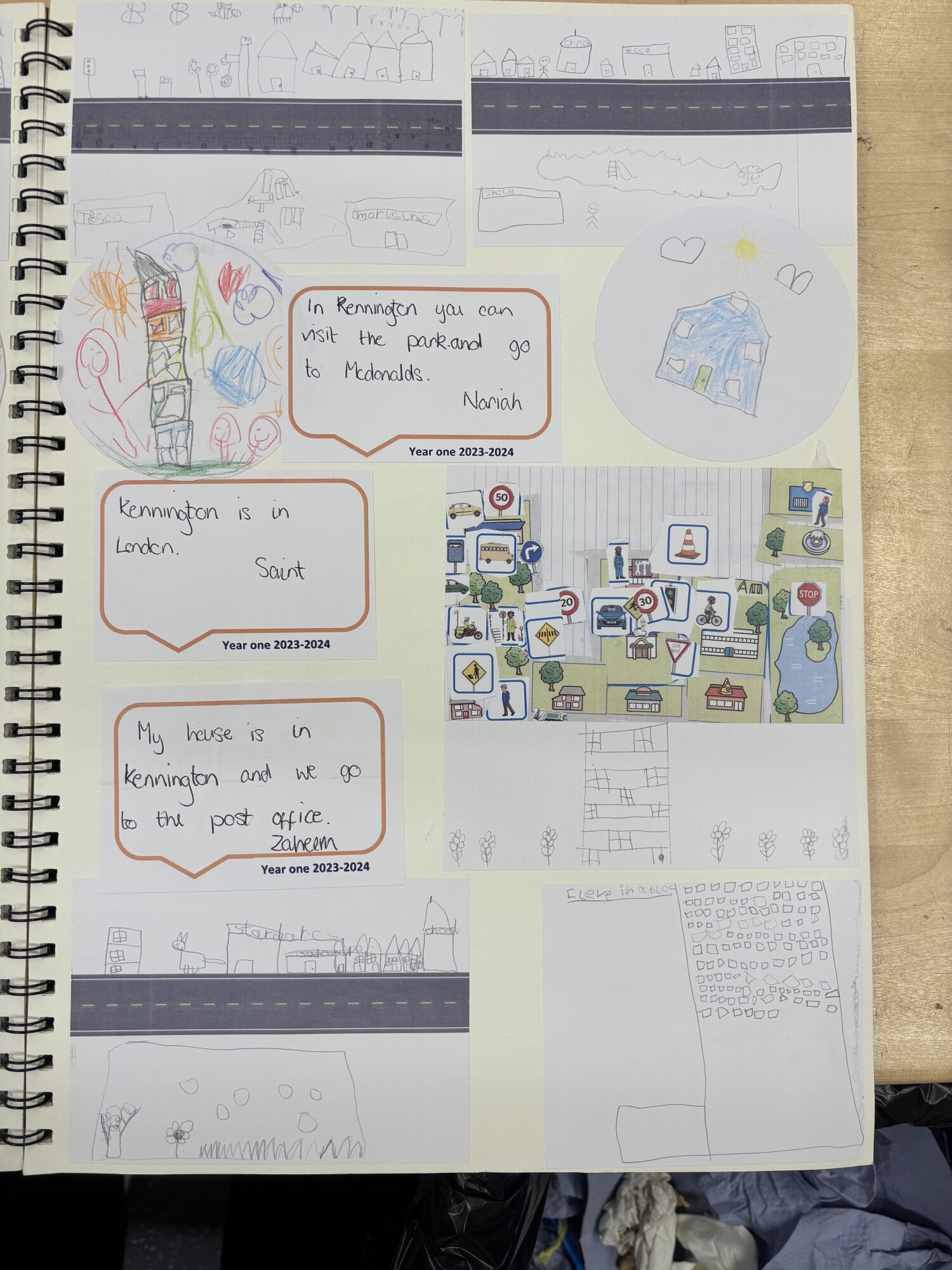
In Year 1, children begin by studying their local area, learning to use simple fieldwork and observational skills to explore their surroundings. Through topics such as Explorers, Looking After Our World: Polar Regions, and Looking After Our World: The Amazon, they are introduced to basic geographical vocabulary to describe key human and physical features. They learn how to devise simple maps and construct basic symbols in a key. As they develop their locational and place knowledge, they begin to explore non-European countries, learning about climate and the impact of environmental change on people and places. These early topics lay the groundwork for understanding the relationship between people and the world around them.
Year 2
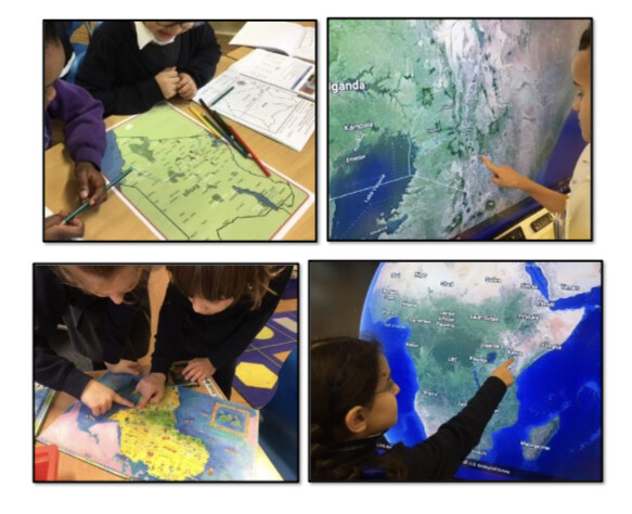
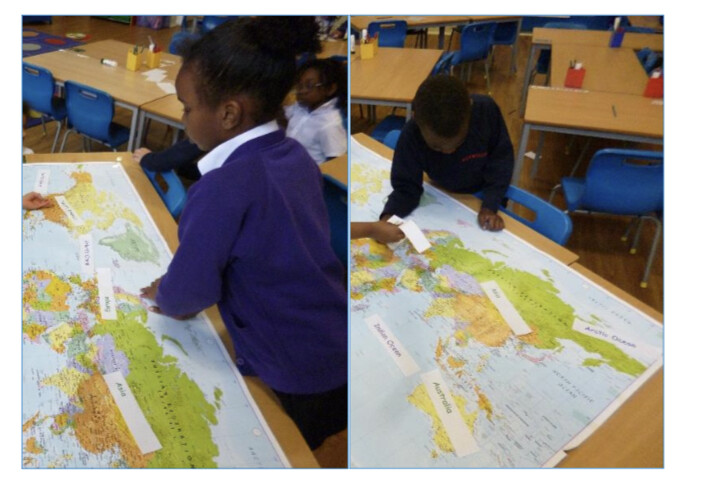
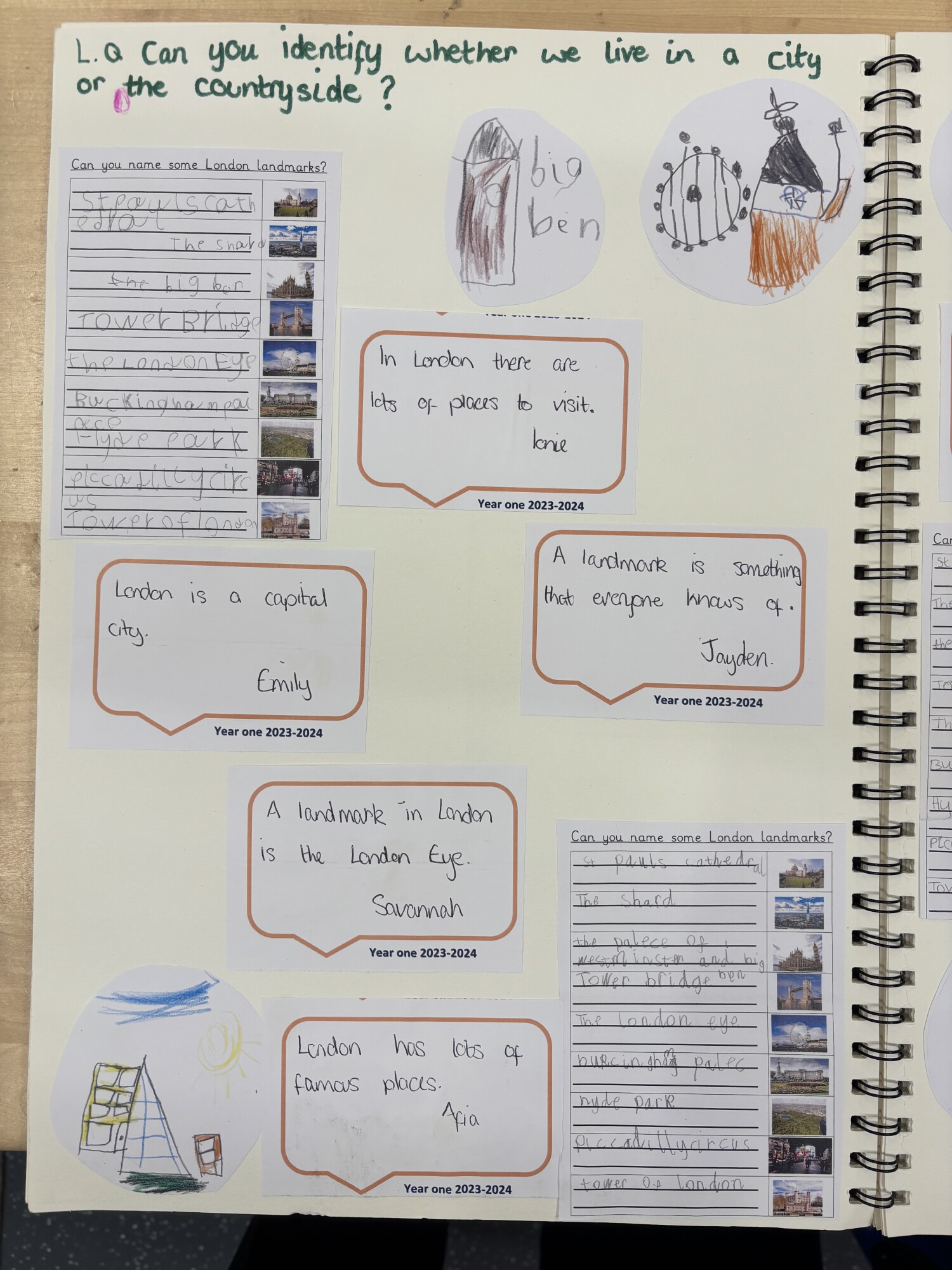
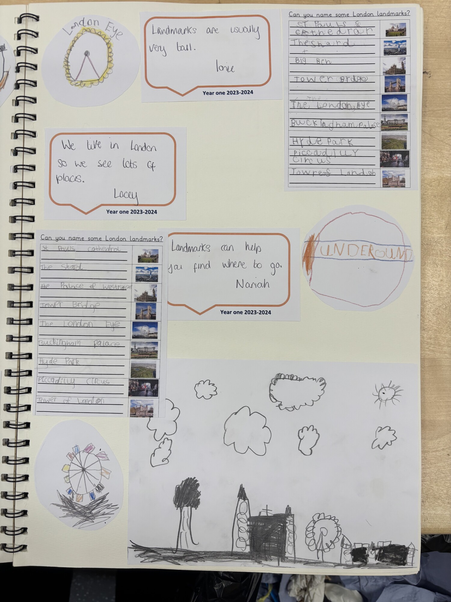
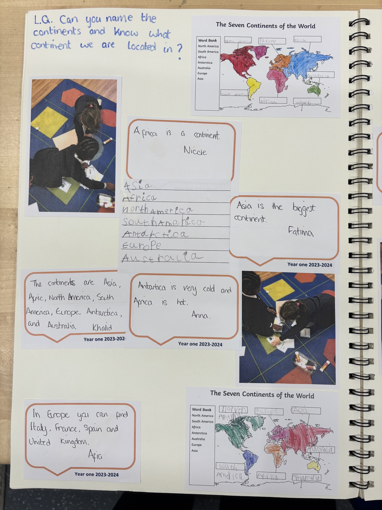
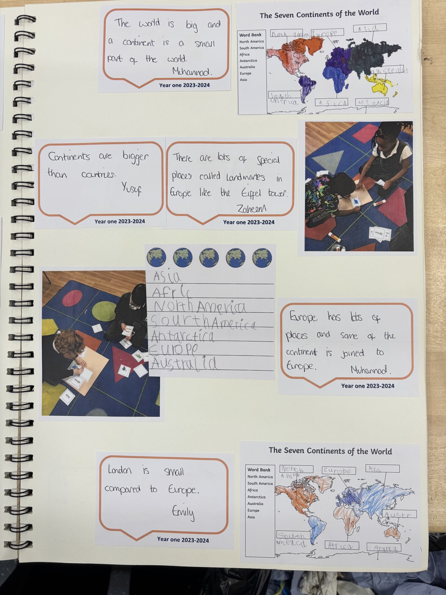
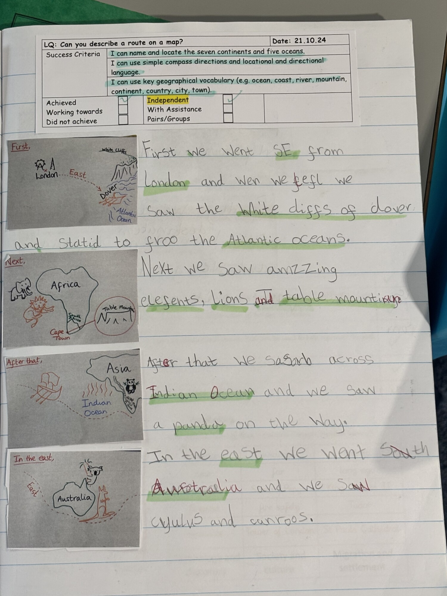
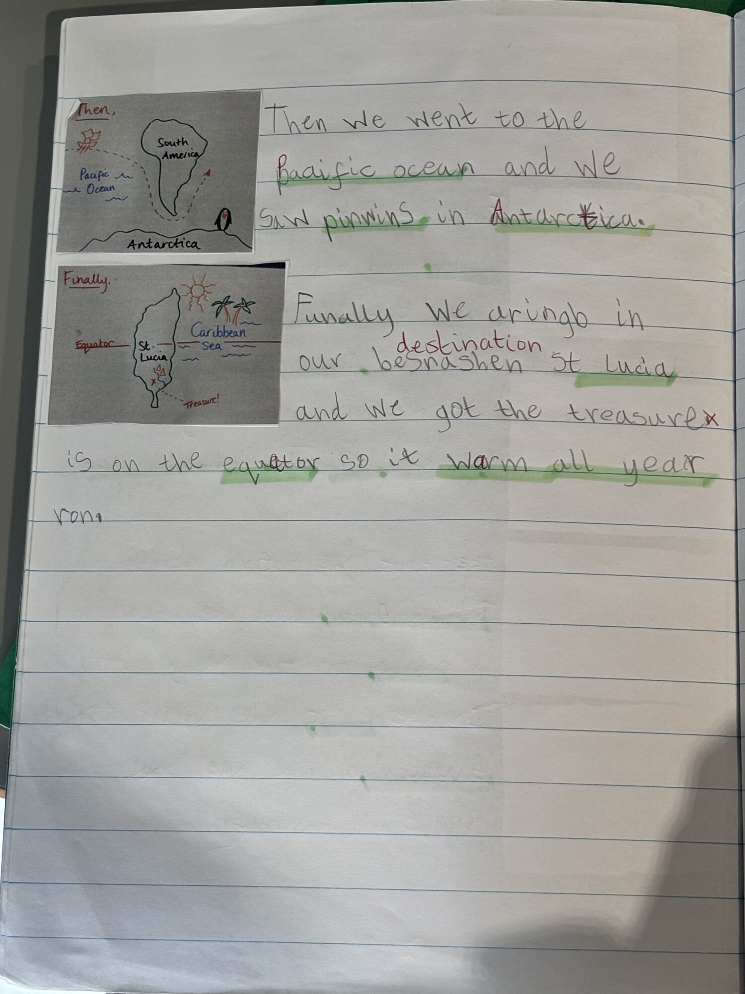
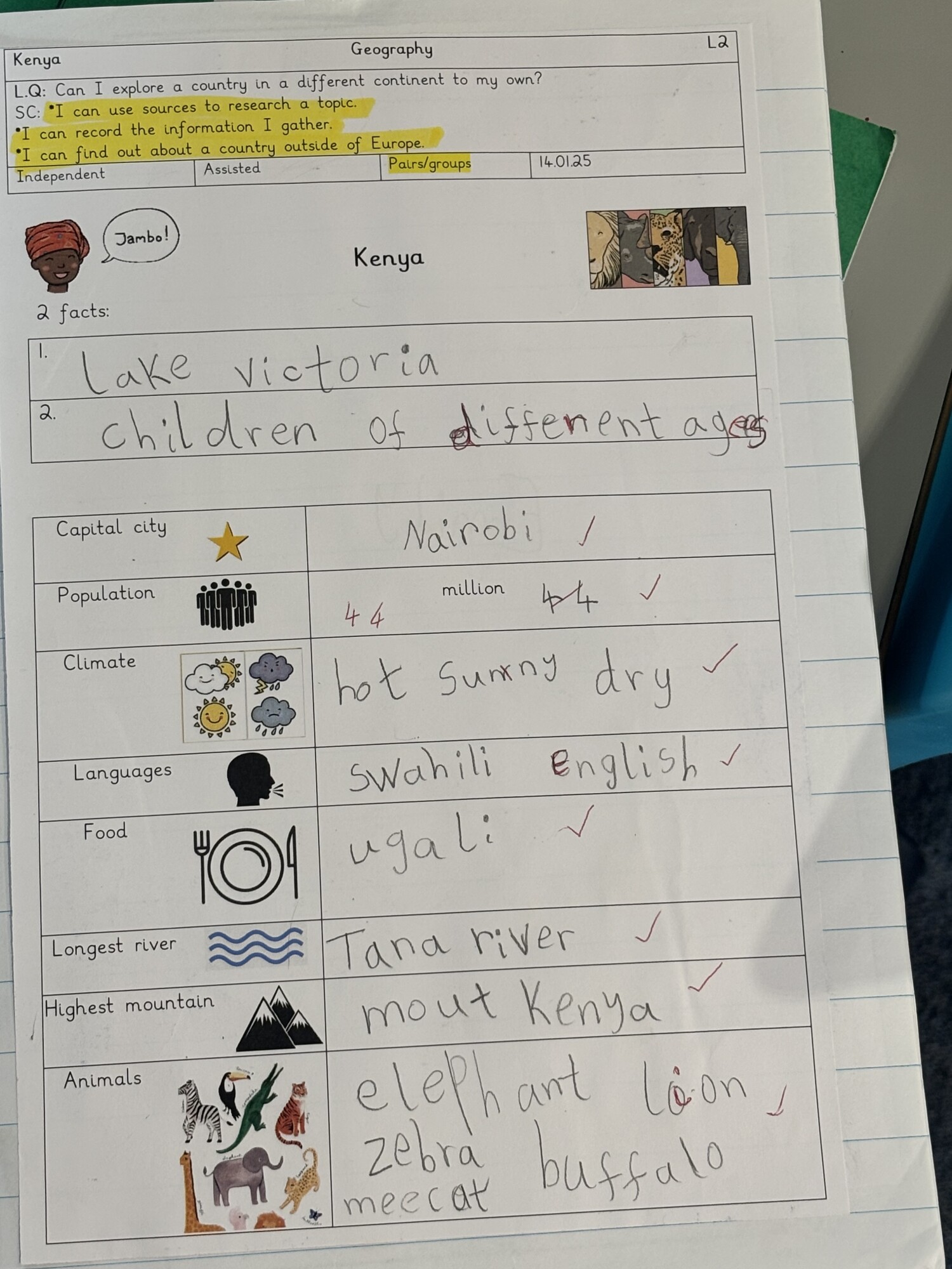
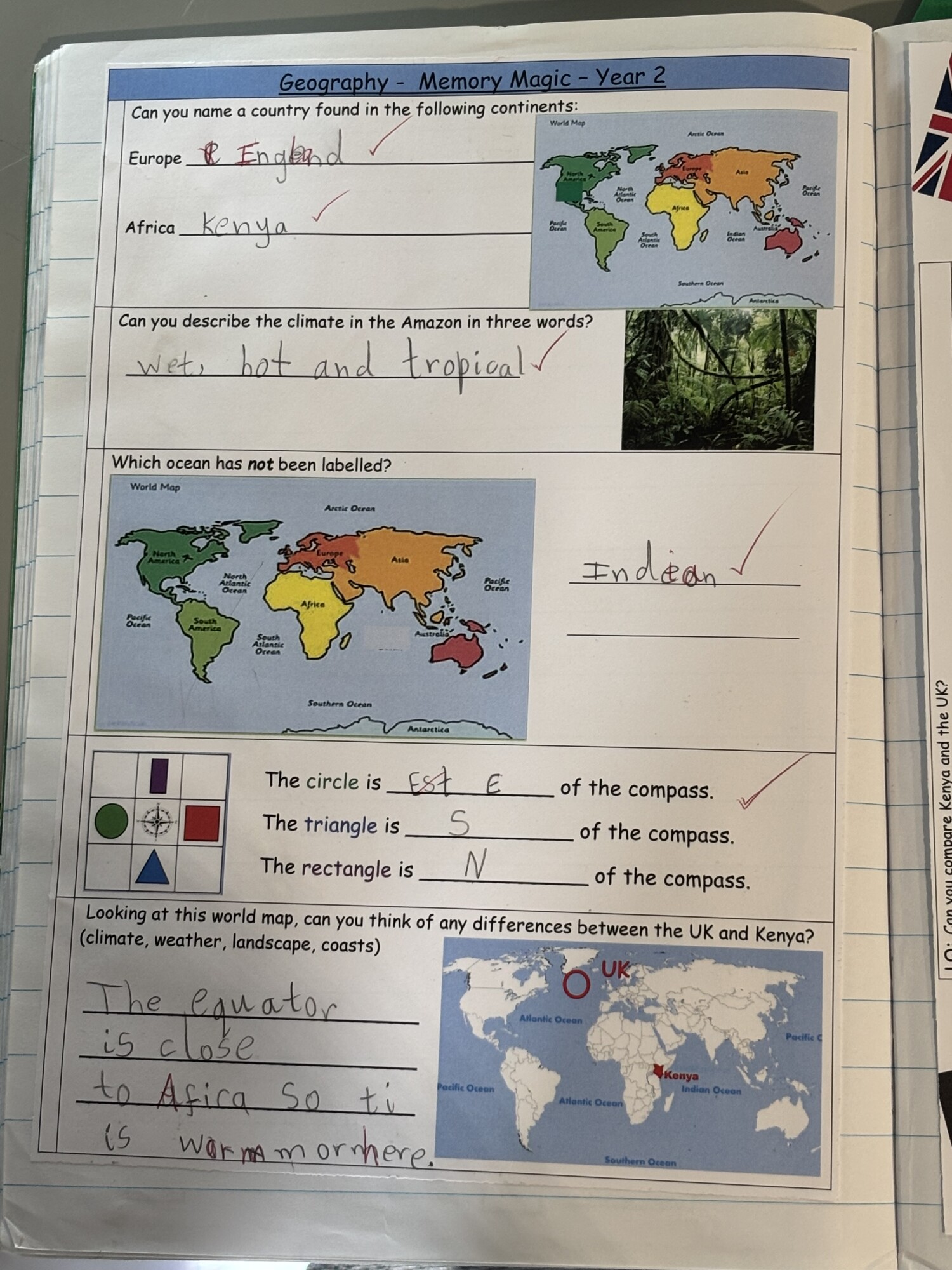
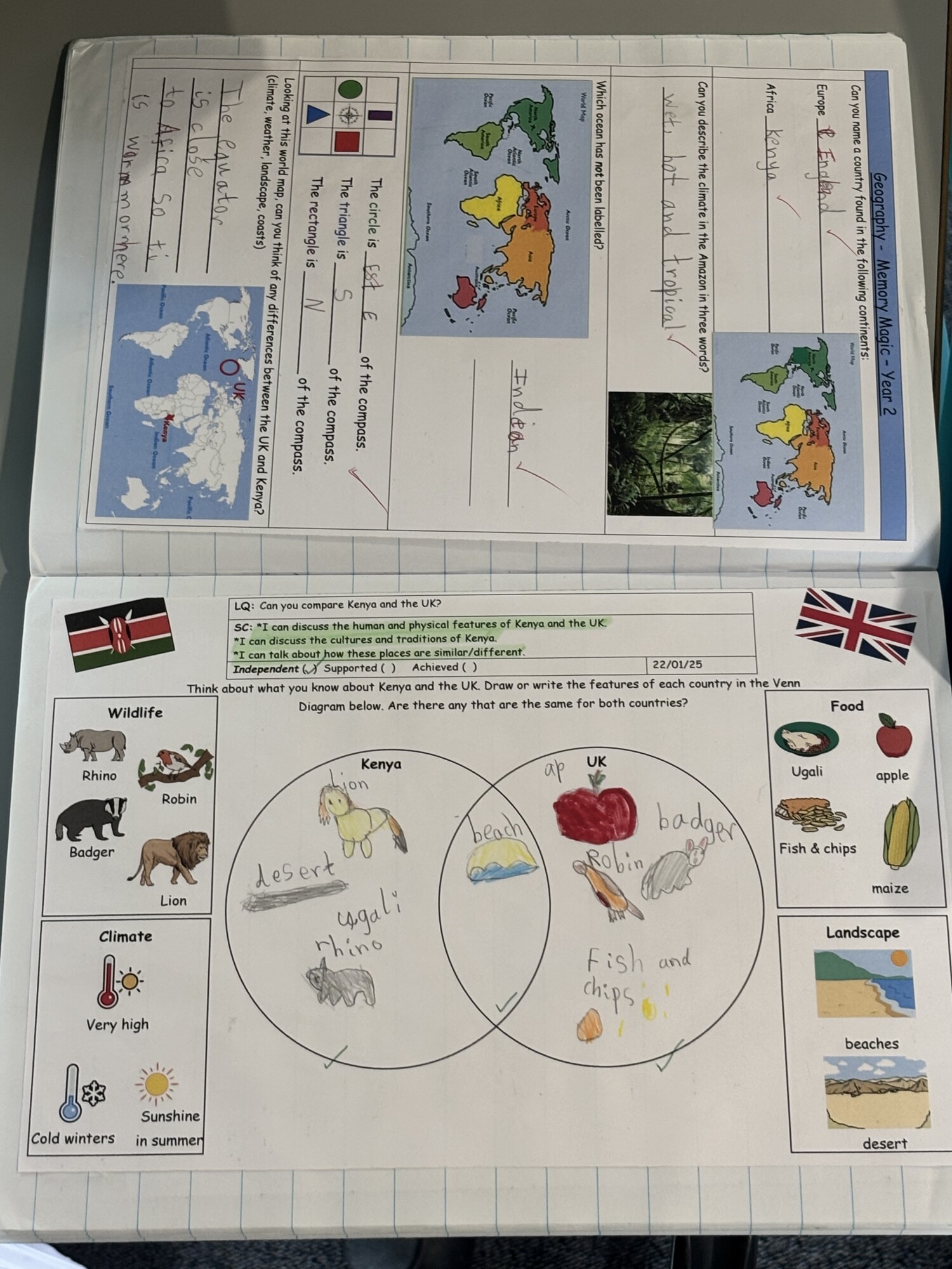
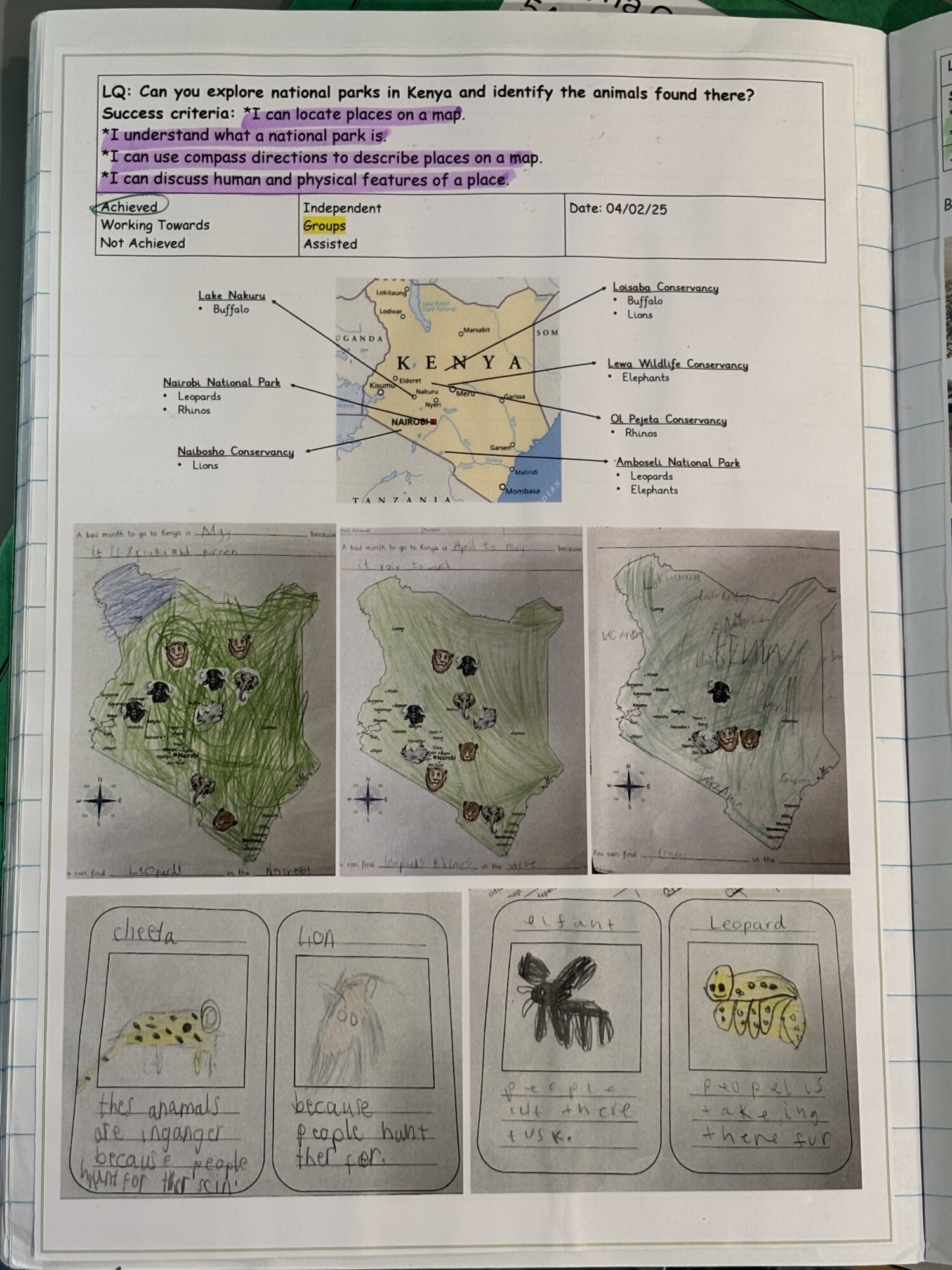
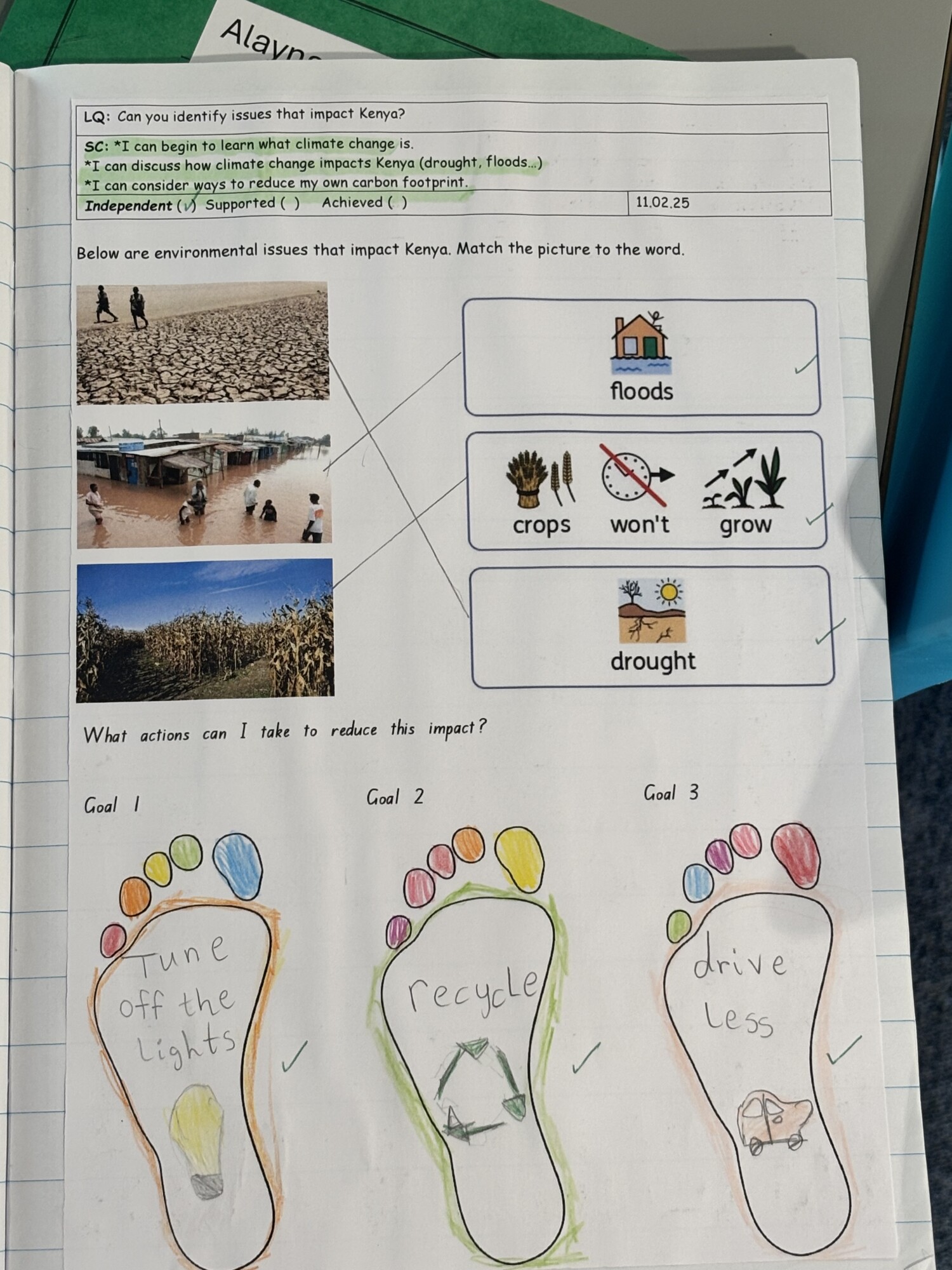
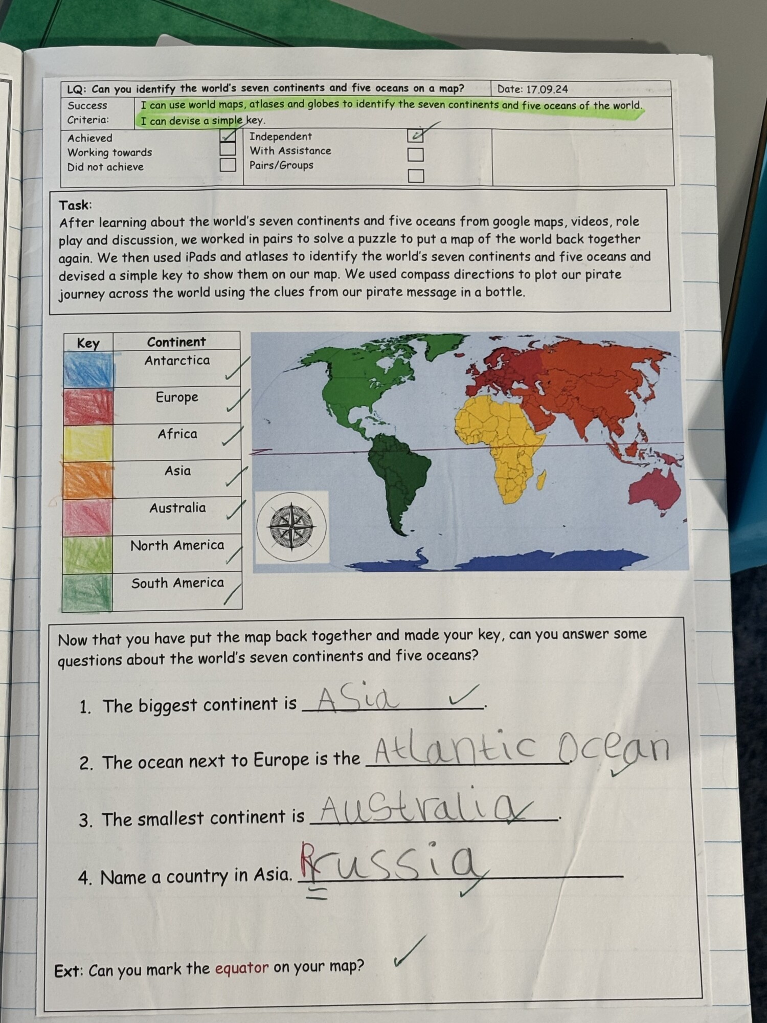
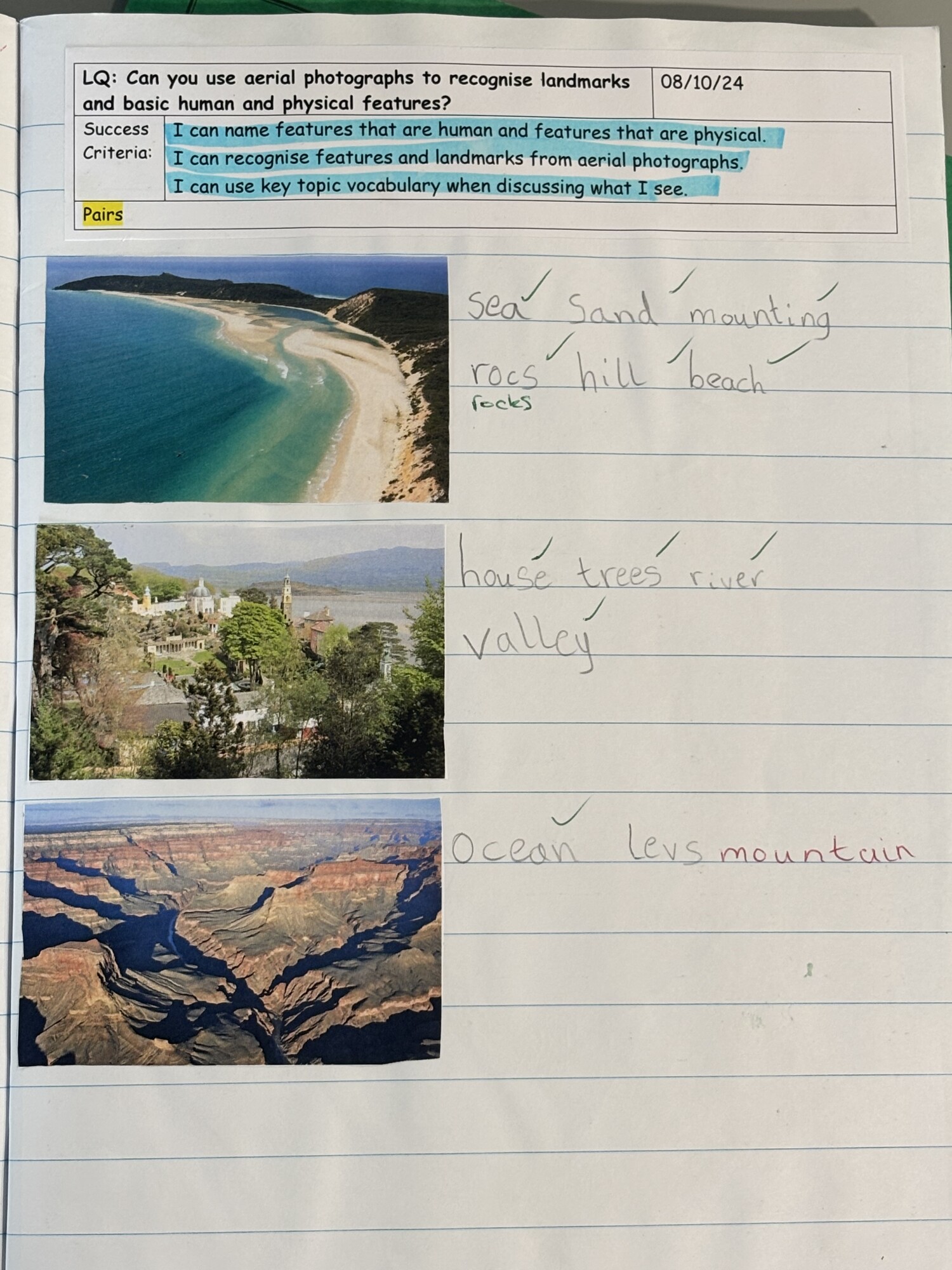
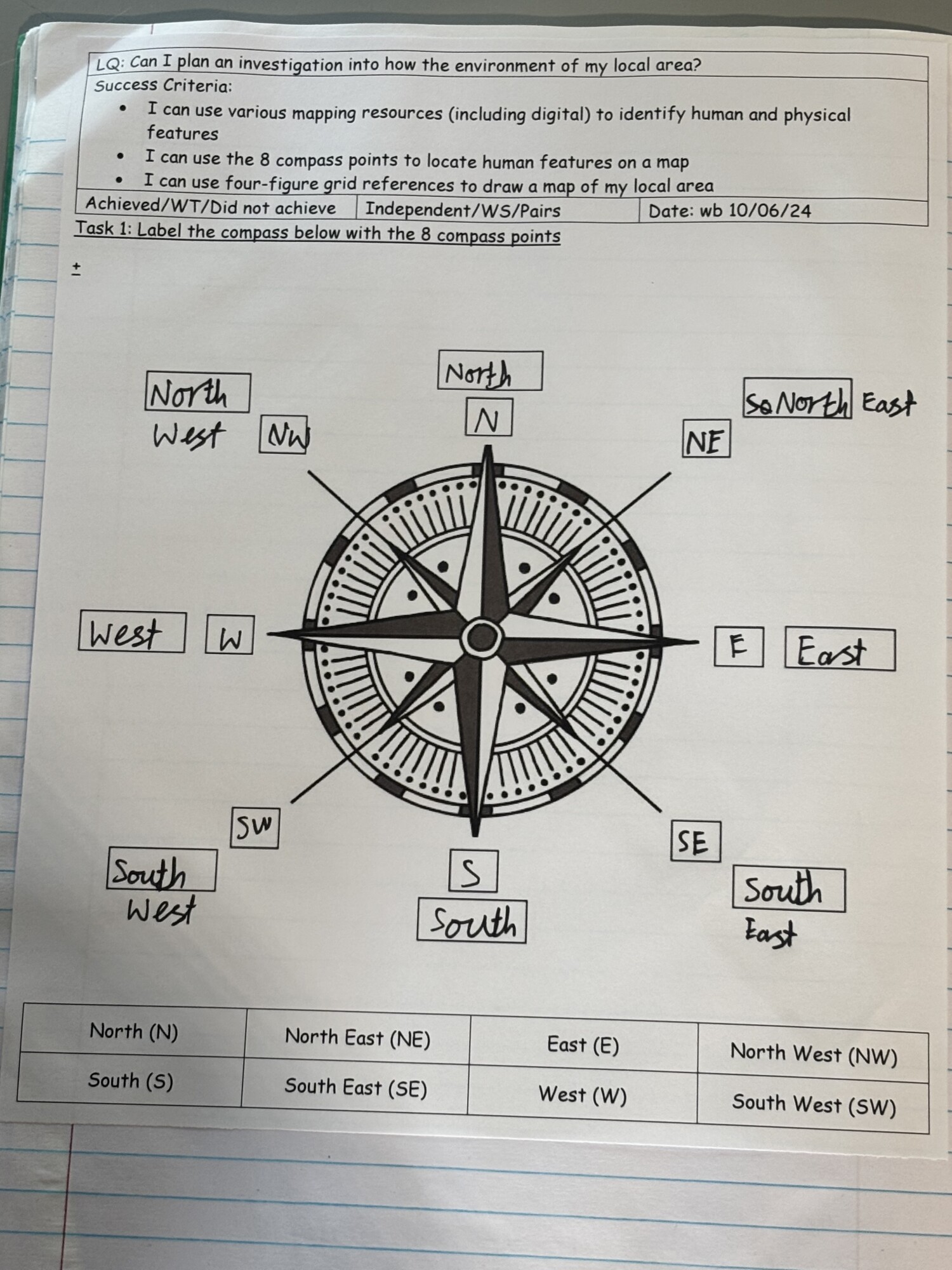
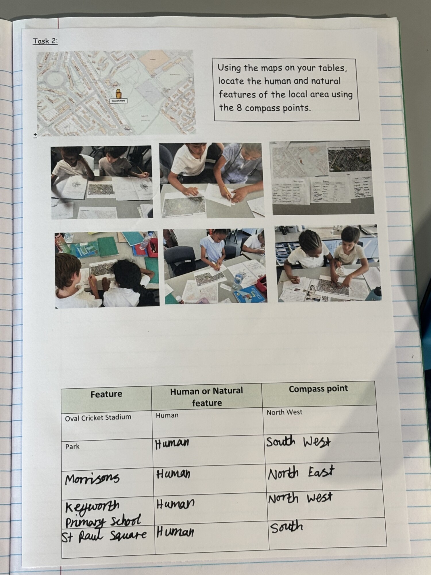
In Year 2, the children deepen their locational and place knowledge through topics like Continents and Oceans: Pirates, Hot and Cold Places: Kenya, and The Seaside. They are able to name and locate the seven continents and five oceans confidently. Using world maps, atlases, and globes, they can identify the United Kingdom, its countries, and the continents and oceans studied. They also identify the location of hot and cold areas in relation to the Equator and the Poles, and begin to explore geographical similarities and differences between the UK and a contrasting non-European country. With improved fieldwork skills, they learn to use simple compass directions and directional language to describe routes and locations on a map.
Year 3
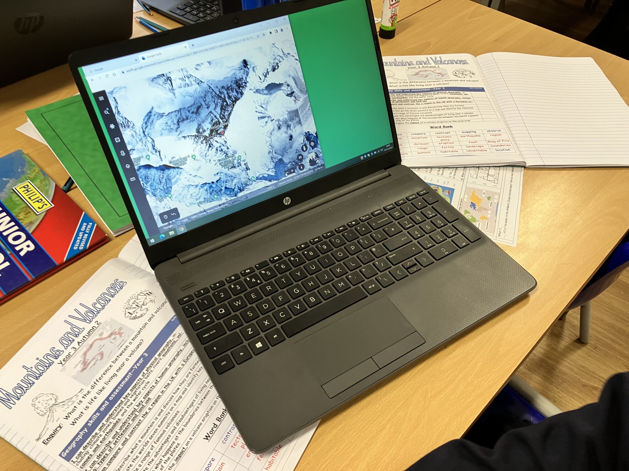
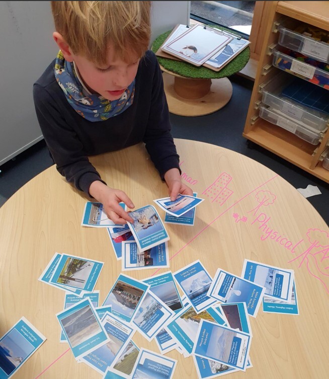
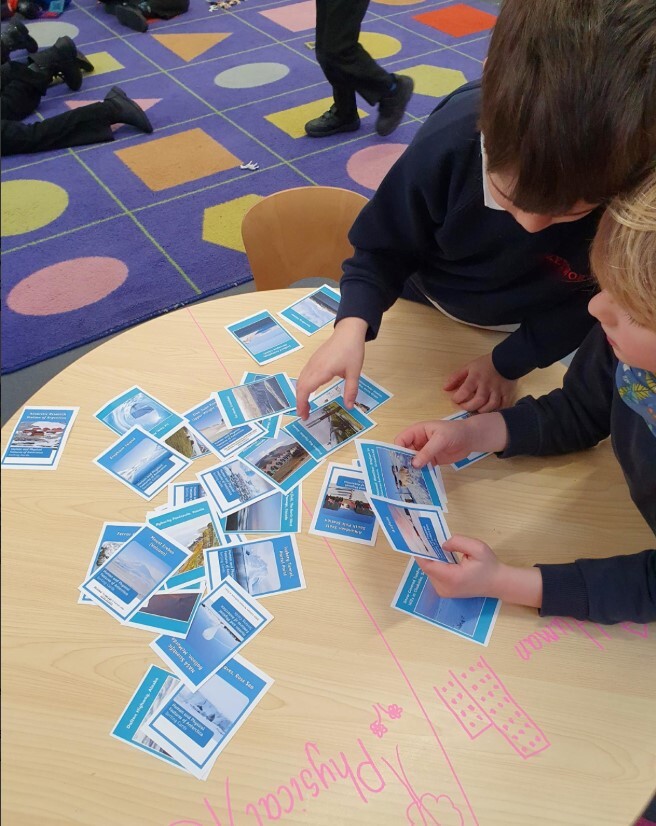
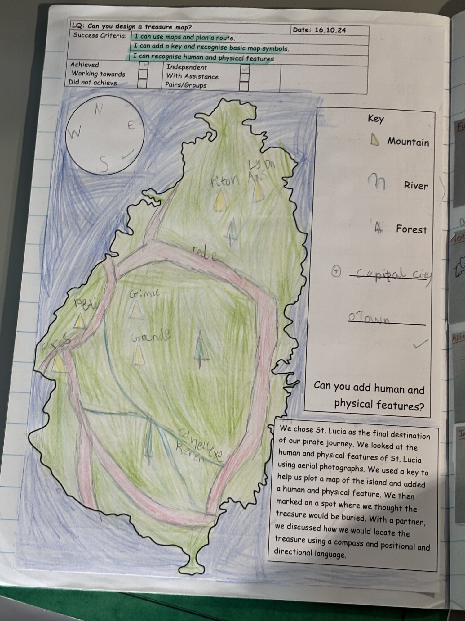
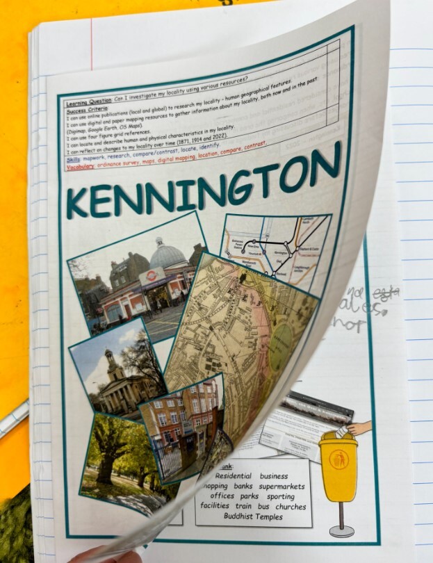
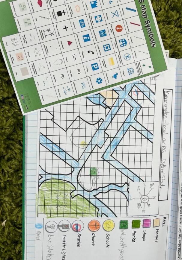
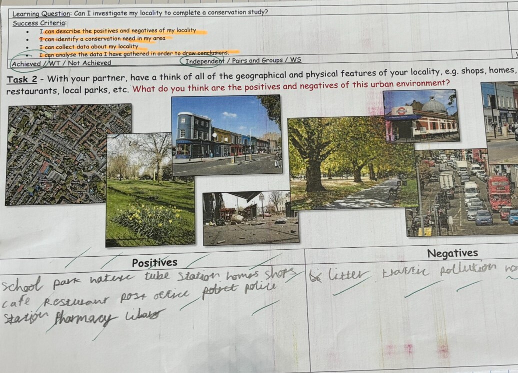
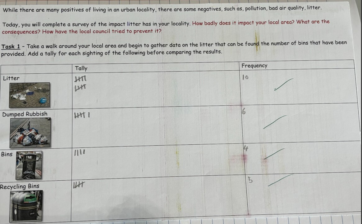
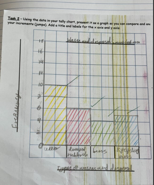
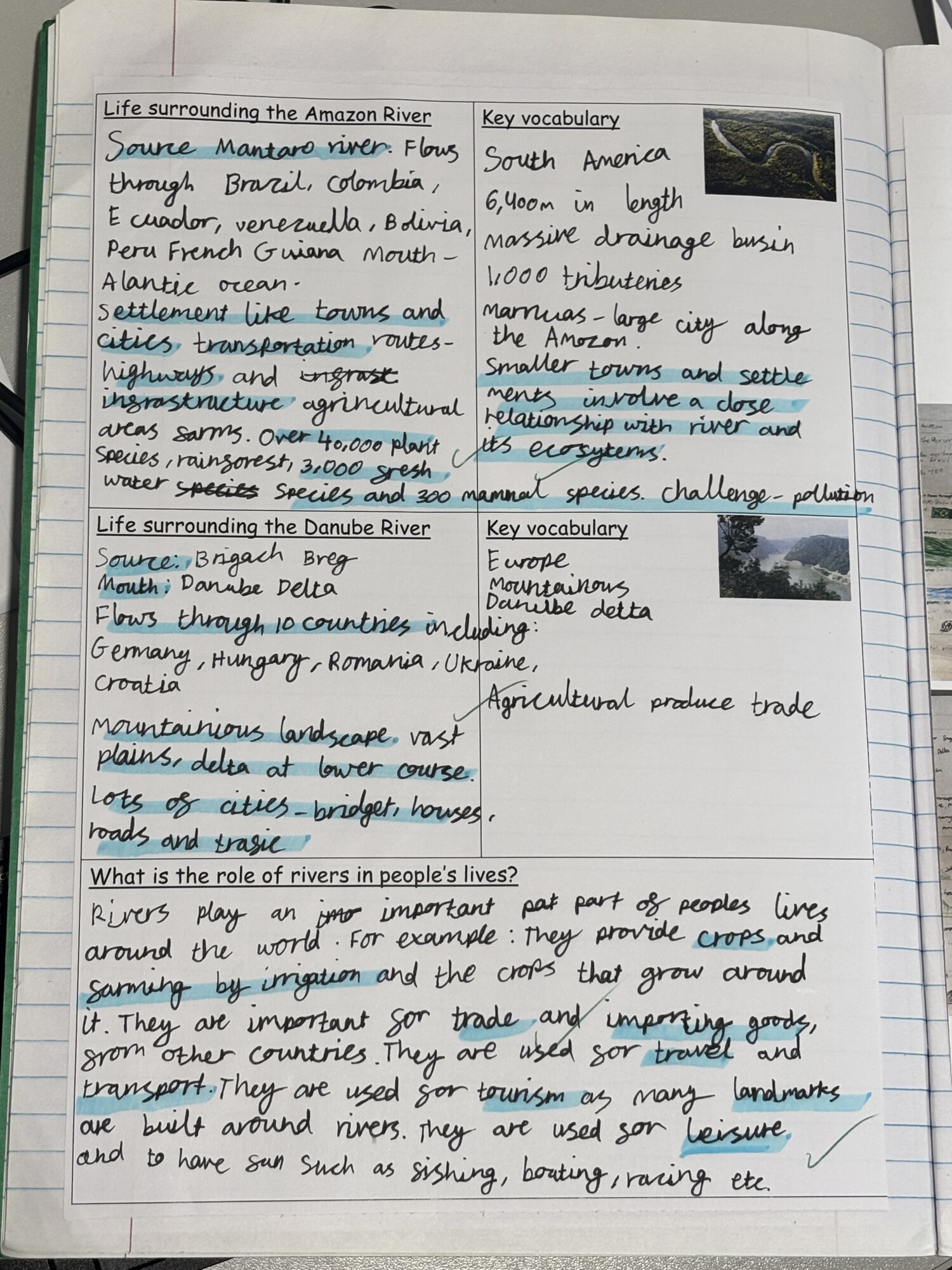
Year 3 builds on previous knowledge through topics such as Mountains and Volcanoes, Conservation and My Local Area, and South America: Climate Zones and Biomes. The children develop greater independence in mapping, introducing more detailed geographical tools and techniques. They explore physical geography, from mountain ranges and volcanic activity around the world to rainforests, rivers, and biomes in South America. They also examine human geography, such as the farming practices of the Sherpa people in Nepal and urban life in London. These comparisons help them make connections between human activity and the natural environment, identifying how people interact with and adapt to their surroundings.
Year 4
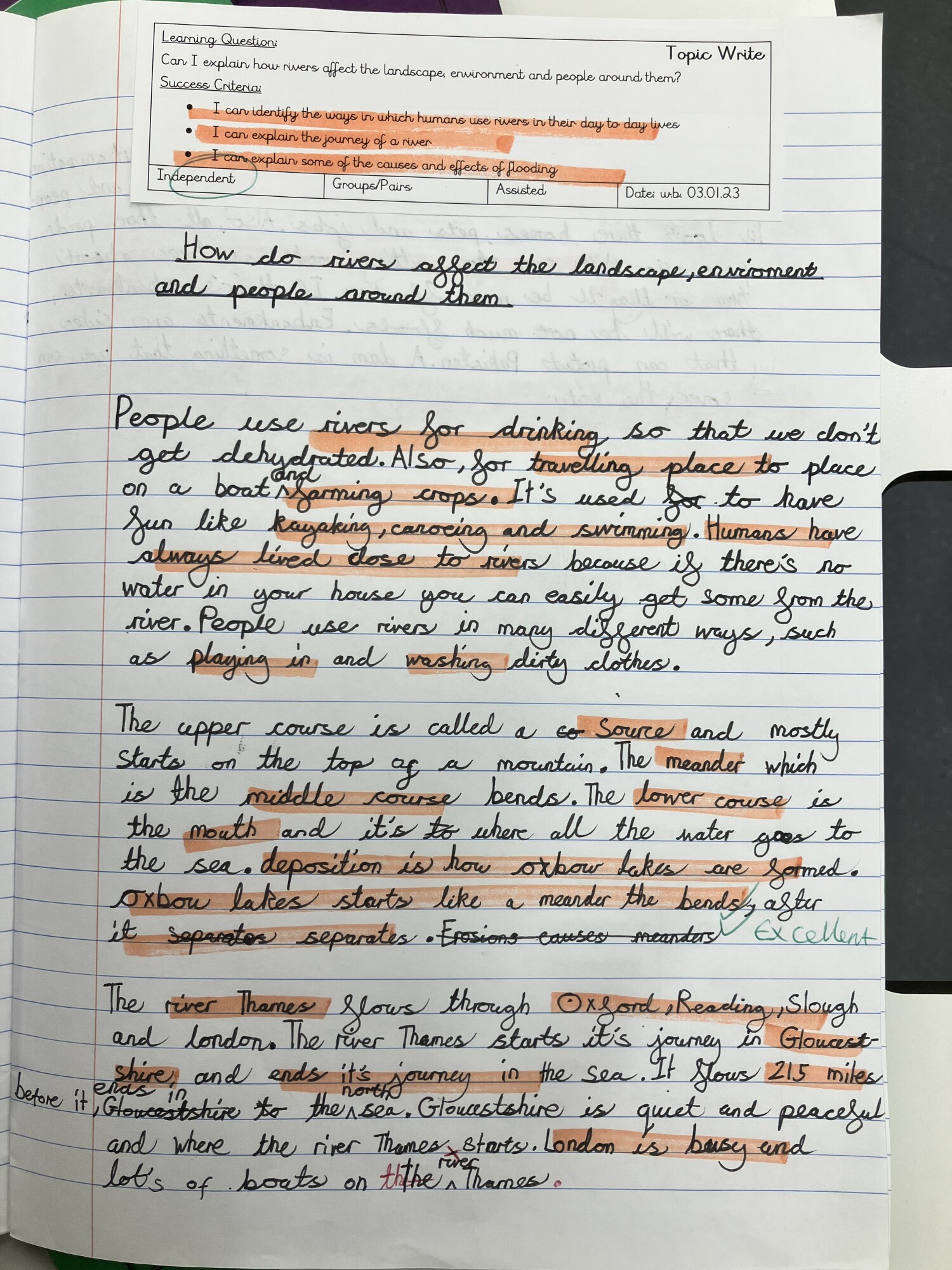
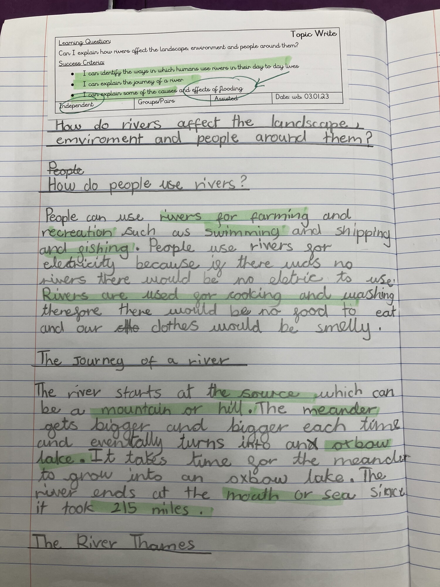
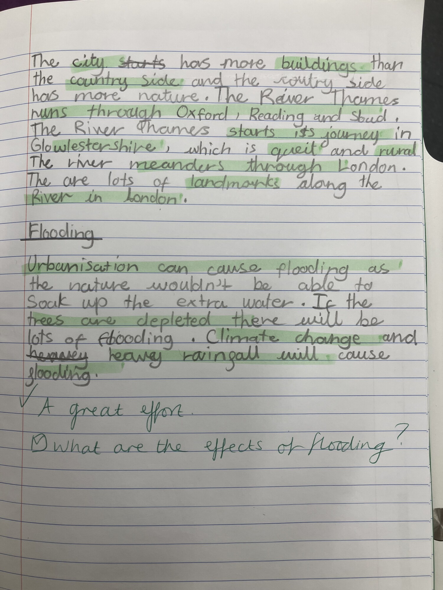
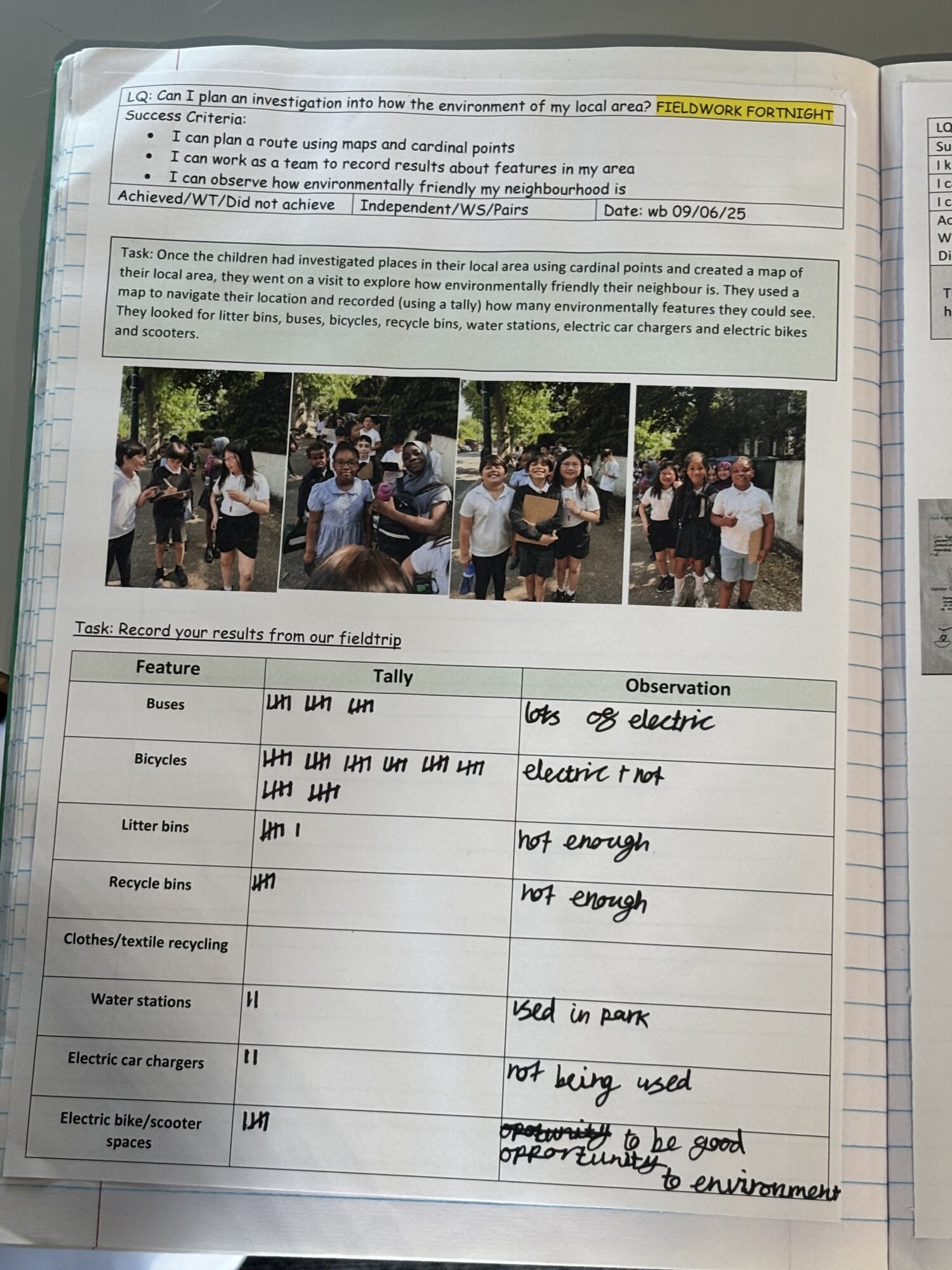
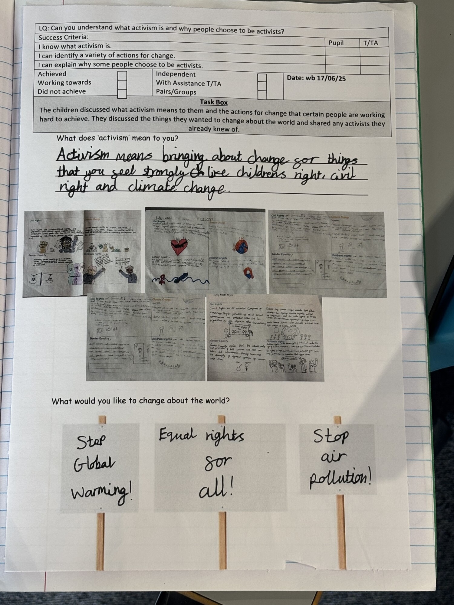
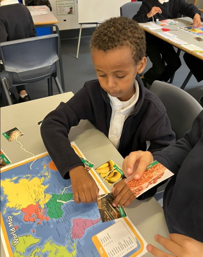
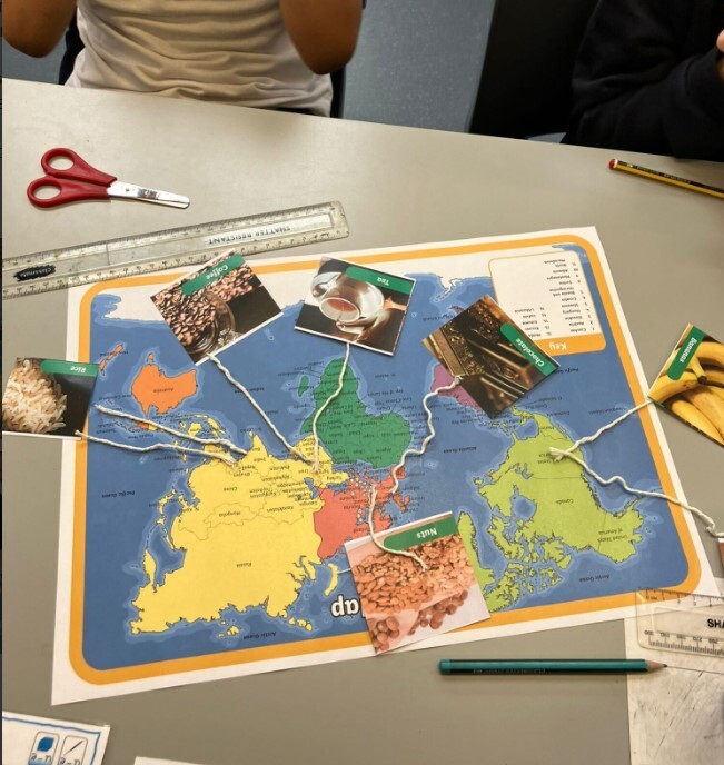
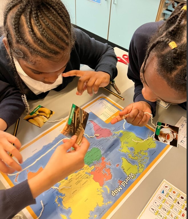
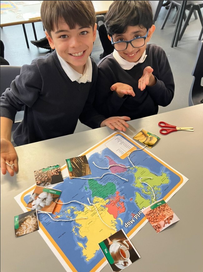
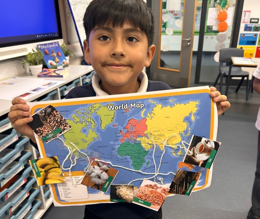
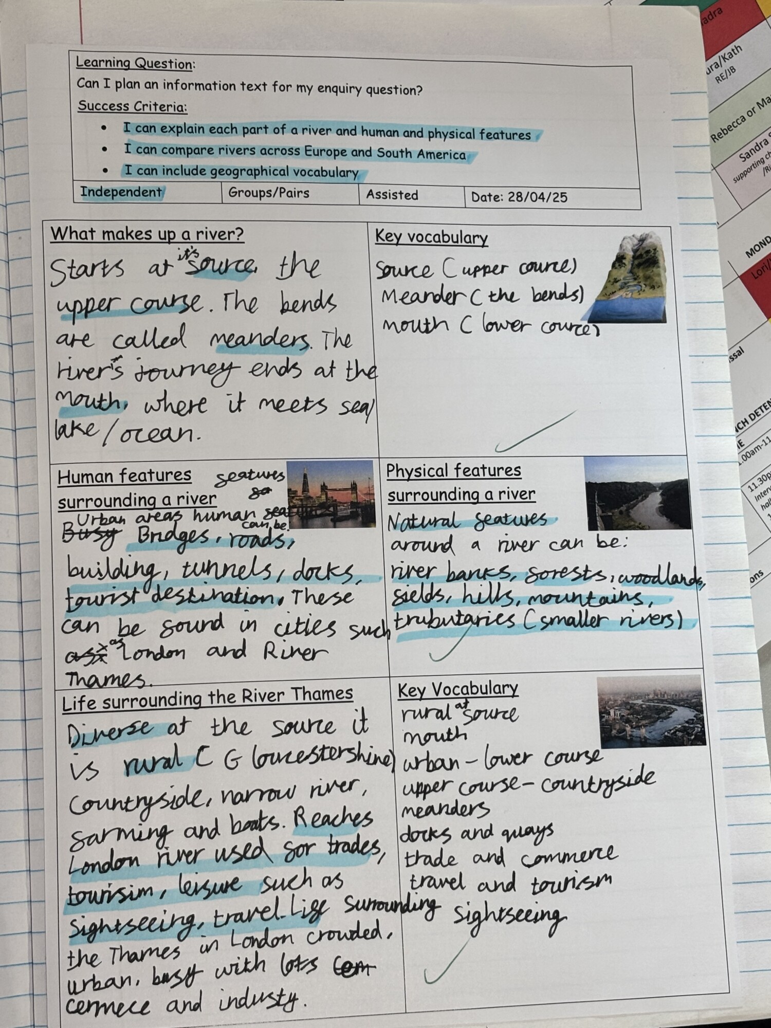
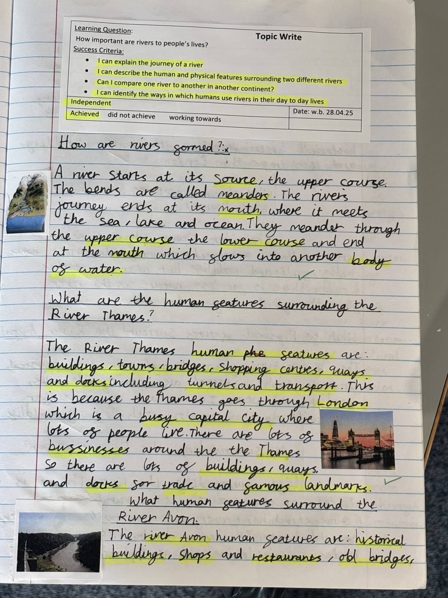
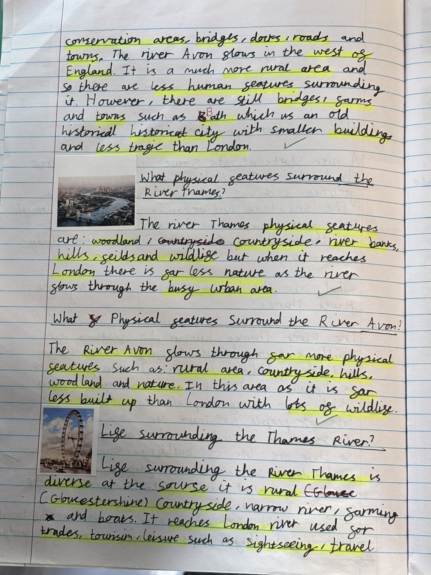
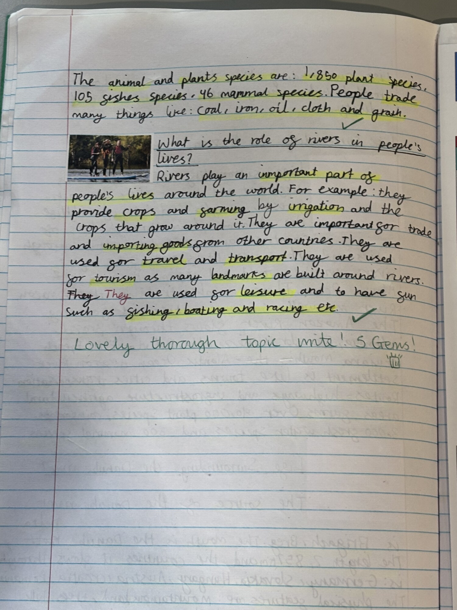
In Year 4, the children explore topics including Food and Agriculture, Rivers, and Environmental and Social Activism. These topics allow them to further develop their geographical skills and become more independent in their investigations. They learn to communicate geographical information in a variety of ways and explore both human and physical geography in more depth. For example, in the Food and Agriculture unit, they examine how physical geography influences trade and economic activity in different parts of the world. They also begin to understand the role of people in shaping the environment, reflecting on social and environmental responsibilities.
Year 5
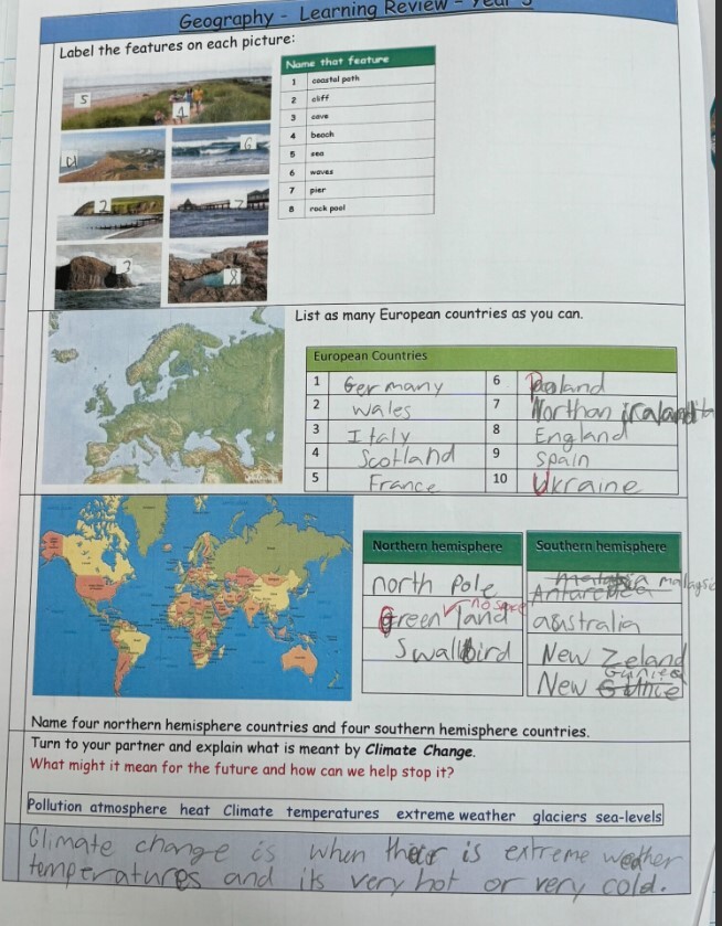
In Year 5, the children study, The UK, North America, and The Environment and Climate Change, extending their place and locational knowledge. They investigate how places have changed and developed over time, drawing connections to their history learning. Through a deeper study of physical geography—including climate, topography, and land use—and human geography, they explore the diversity within continents. Children identify links between natural features and human characteristics, such as settlement patterns, trade, and transport. They also build upon previous learning about climate change, considering both its causes and its global impacts.
Year 6
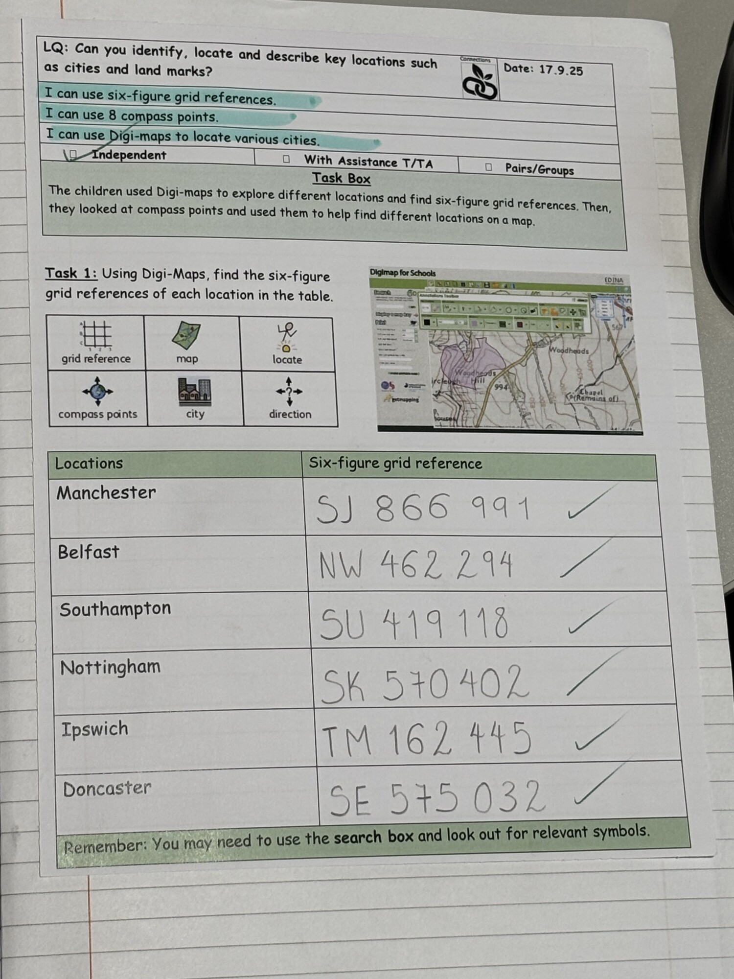
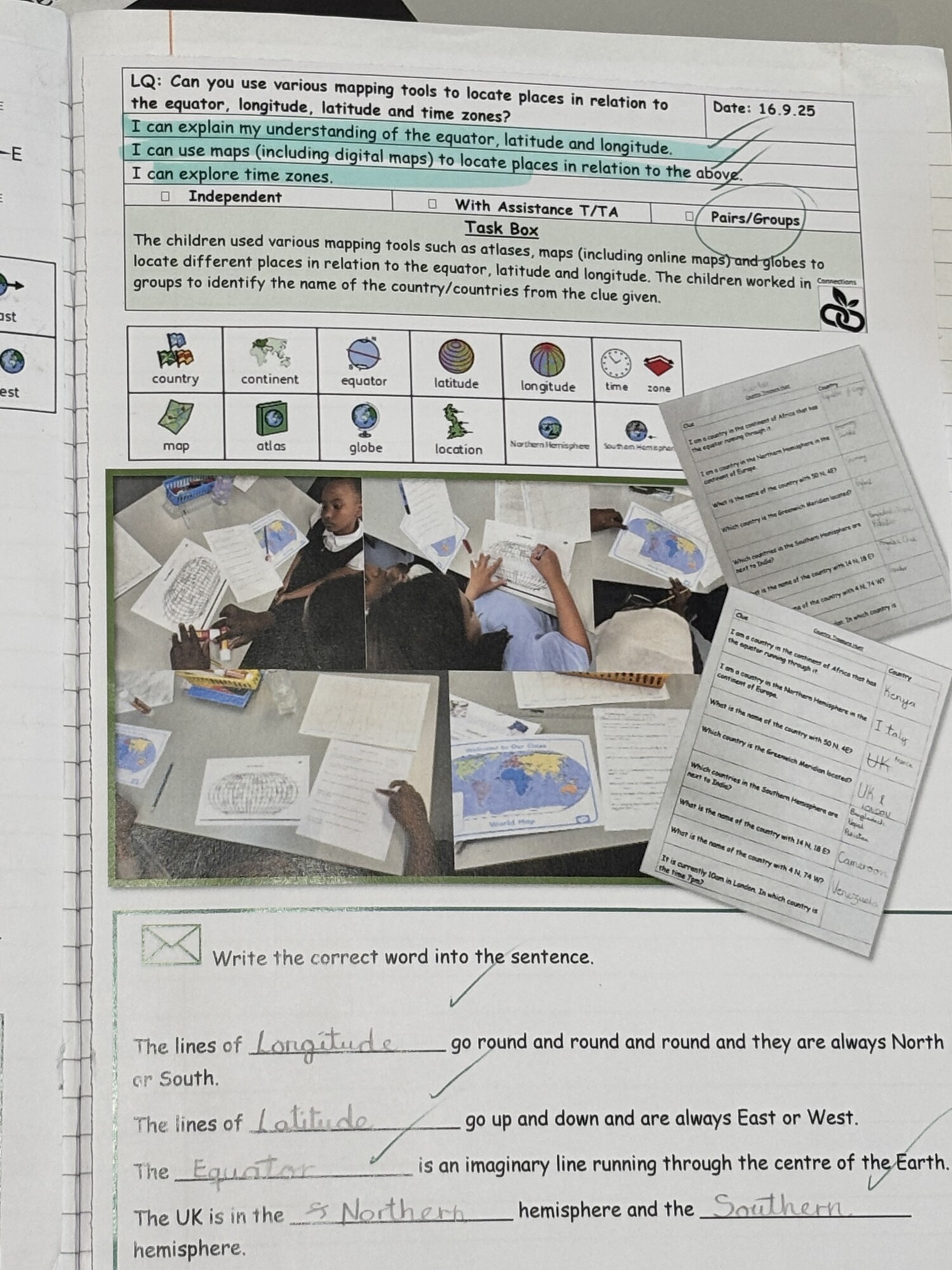
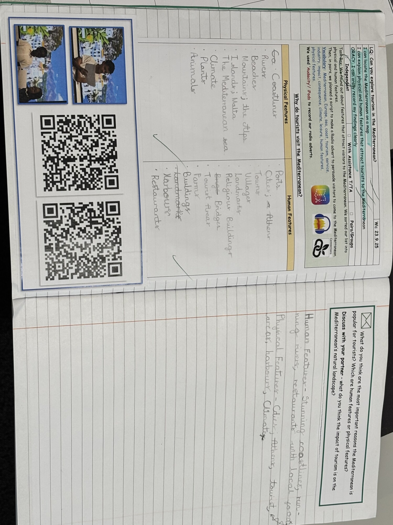
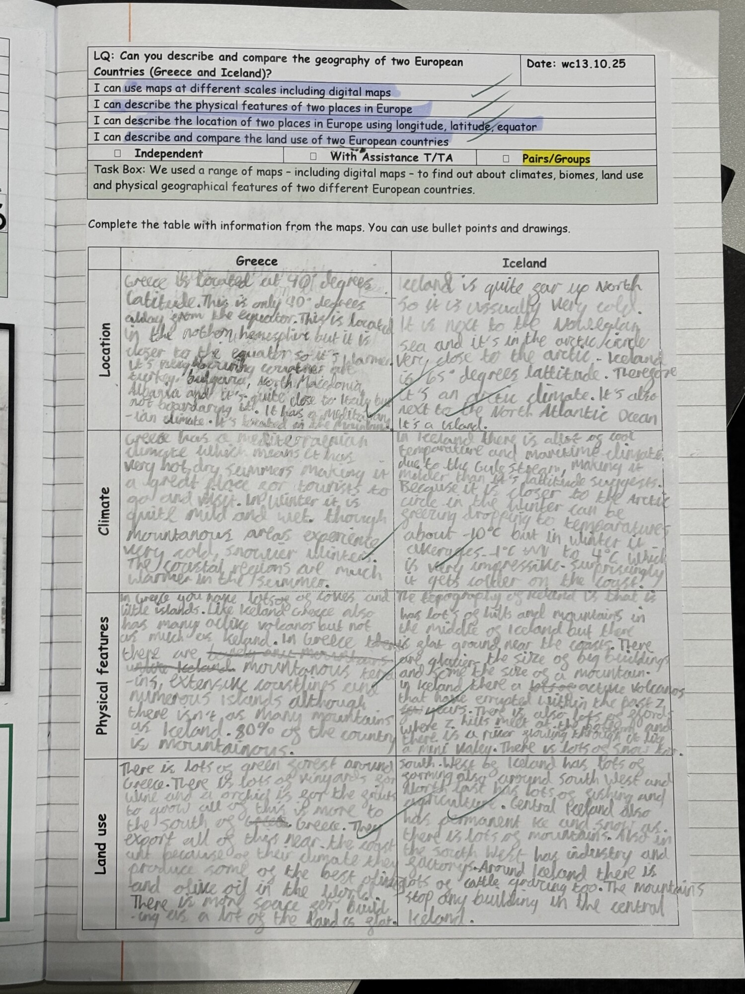
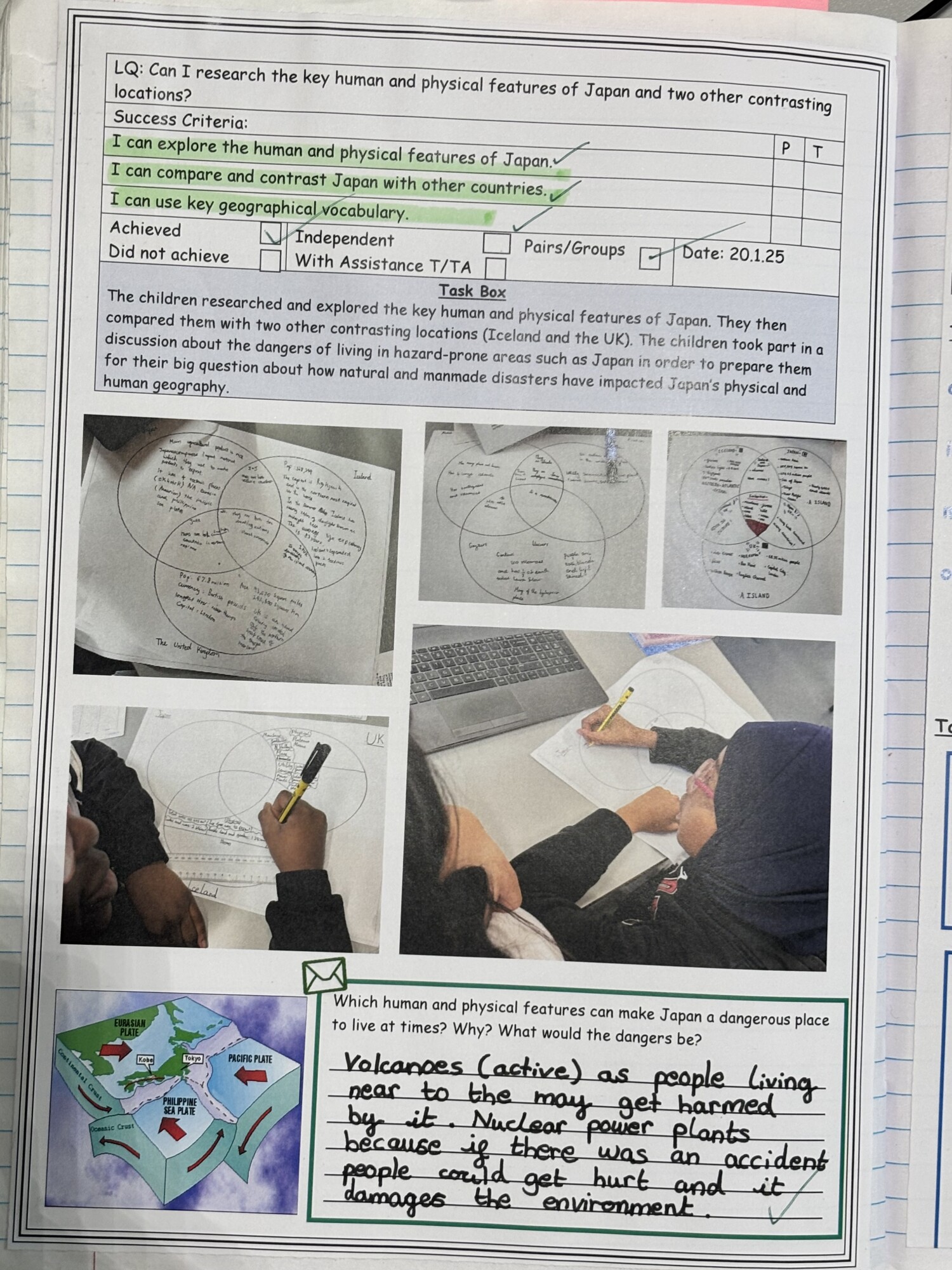
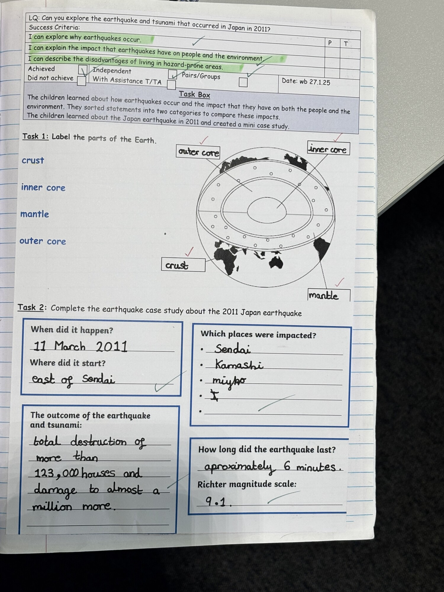
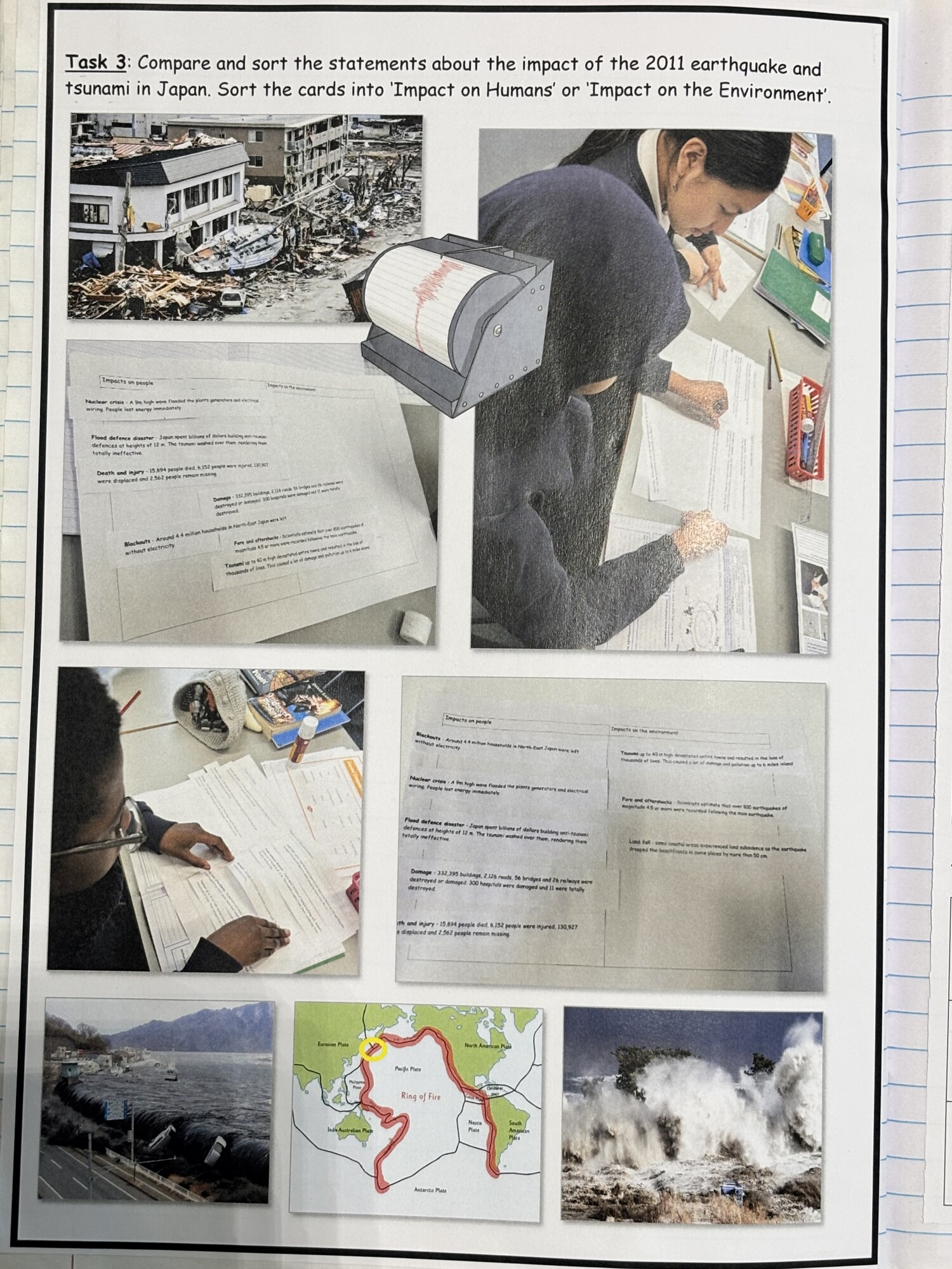
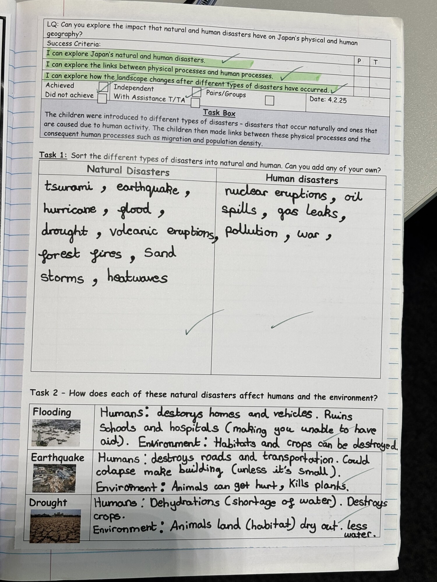
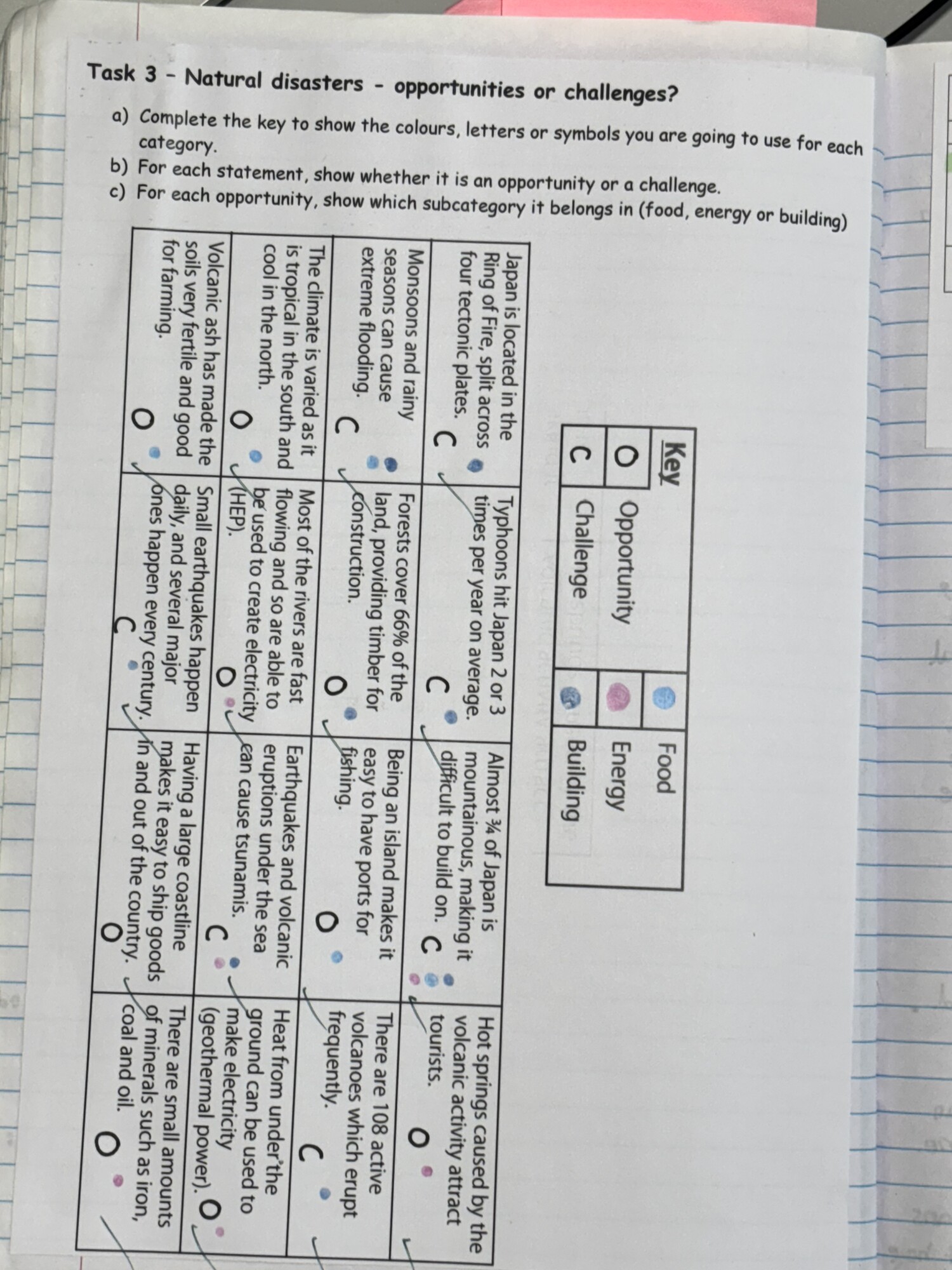
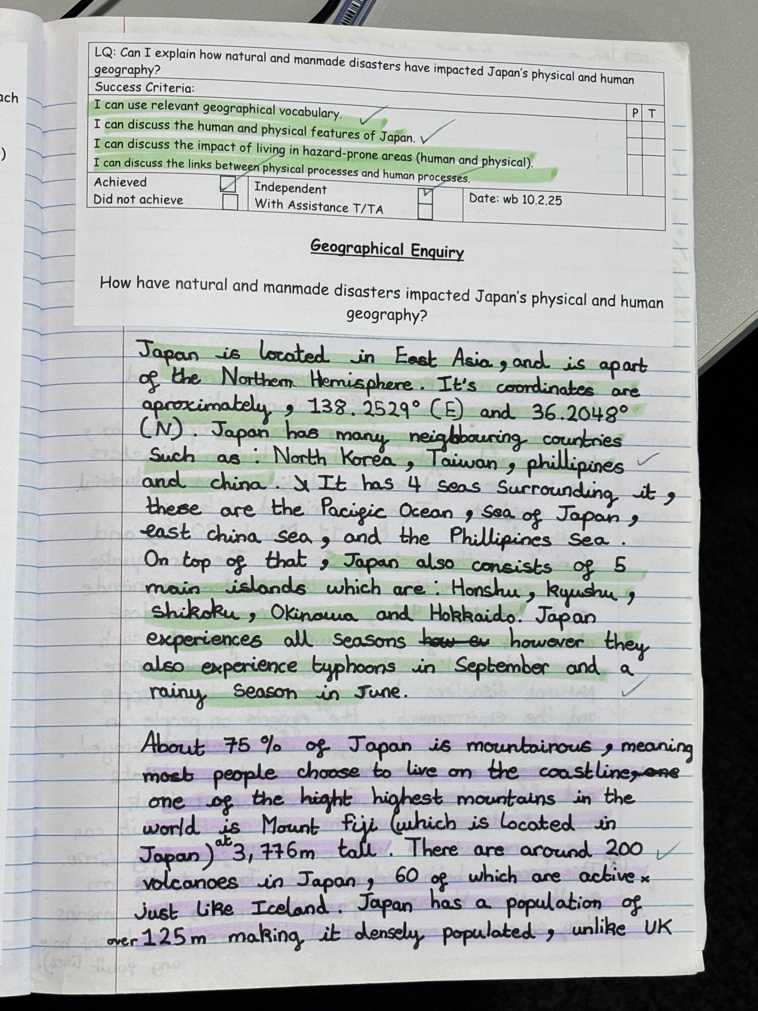
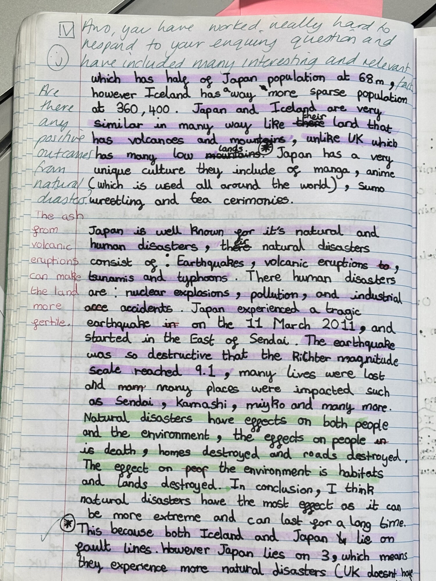
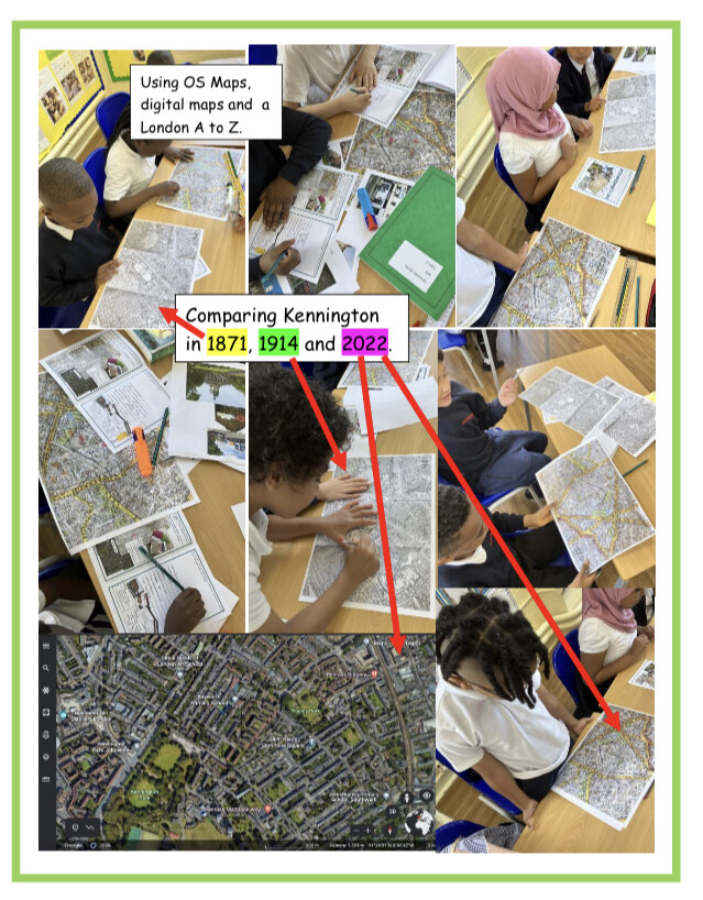
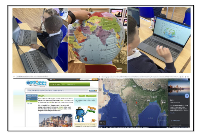
By Year 6, the children have developed strong geographical knowledge and skills, which they apply through topics such as Japan and Europe. They use a wide range of mapping resources with increased sophistication and independence, including digital maps, atlases, and aerial imagery programs. Their technical vocabulary continues to expand, and they apply it confidently across a variety of geographical contexts. They explore the connection between physical and human processes in greater depth; for example, they examine the impact of volcanic activity in Japan and its influence on settlement, trade, and the economy. Through the study of climate zones, natural environments, topography, trade, and land use, they investigate the diversity and interconnectivity of Europe. By the end of the year, they are confident in making informed geographical comparisons and can clearly articulate the relationship between people and the planet.